You are here: Home > Network List > US - United States National Seismic Network Stations List
> Station MSO Missoula, Montana, USA > Earthquake Result Viewer
MSO Missoula, Montana, USA - Earthquake Result Viewer
*The percent match for this event was below the threshold and hence no stack was calculated.
| Earthquake location: |
Northern Mid-Atlantic Ridge |
| Earthquake latitude/longitude: |
10.8/-43.4 |
| Earthquake time(UTC): |
2011/07/27 (208) 23:00:30 GMT |
| Earthquake Depth: |
10 km |
| Earthquake Magnitude: |
5.6 MB, 5.6 MS, 6.0 MW, 5.9 MW |
| Earthquake Catalog/Contributor: |
WHDF/NEIC |
|
| Network: |
US United States National Seismic Network |
| Station: |
MSO Missoula, Montana, USA |
| Lat/Lon: |
46.83 N/113.94 W |
| Elevation: |
1264 m |
|
| Distance: |
68.9 deg |
| Az: |
316.056 deg |
| Baz: |
96.774 deg |
| Ray Param: |
$rayparam |
*The percent match for this event was below the threshold and hence was not used in the summary stack. |
|
| Radial Match: |
66.907234 % |
| Radial Bump: |
400 |
| Transverse Match: |
59.40162 % |
| Transverse Bump: |
400 |
| SOD ConfigId: |
558545 |
| Insert Time: |
2013-09-18 23:39:28.262 +0000 |
| GWidth: |
2.5 |
| Max Bumps: |
400 |
| Tol: |
0.001 |
|
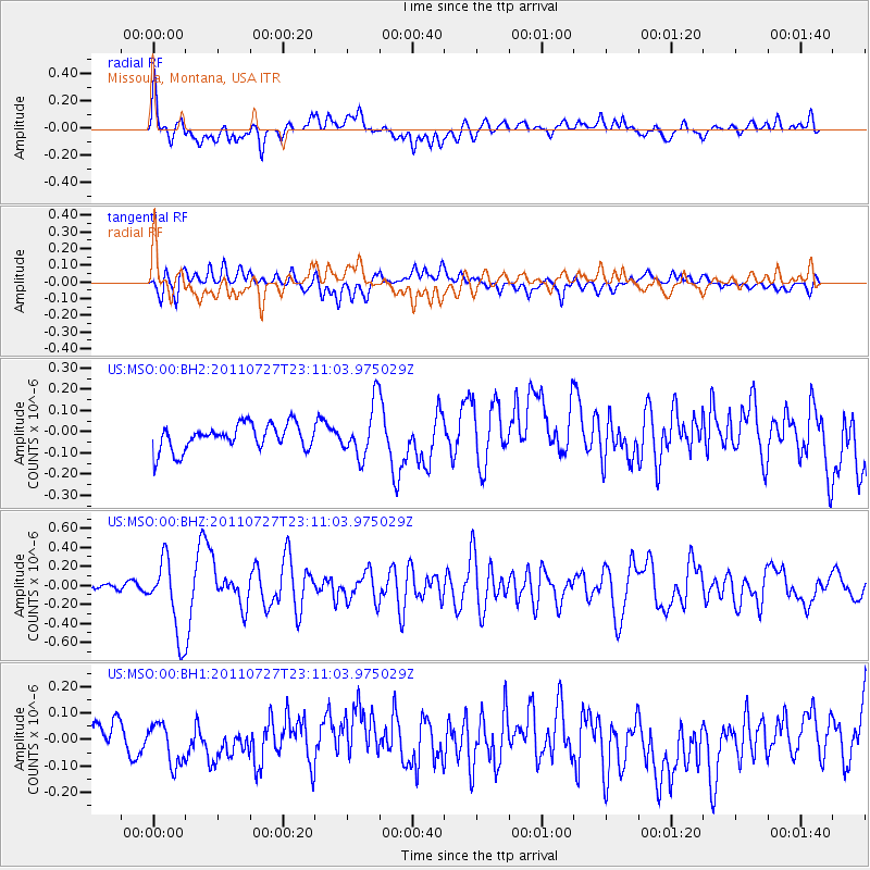
Signal To Noise
| Channel | StoN | STA | LTA |
| US:MSO:00:BHZ:20110727T23:11:03.975029Z | 6.474064 | 4.0149203E-7 | 6.201546E-8 |
| US:MSO:00:BH1:20110727T23:11:03.975029Z | 1.2830896 | 7.543814E-8 | 5.8794132E-8 |
| US:MSO:00:BH2:20110727T23:11:03.975029Z | 2.0412476 | 1.2384625E-7 | 6.0671844E-8 |
| Arrivals |
| Ps | |
| PpPs | |
| PsPs/PpSs | |


