You are here: Home > Network List > US - United States National Seismic Network Stations List
> Station DGMT Dagmar, Montana, USA > Earthquake Result Viewer
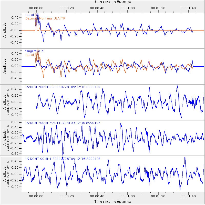
DGMT Dagmar, Montana, USA - Earthquake Result Viewer
*The percent match for this event was below the threshold and hence no stack was calculated.
| Earthquake location: |
Off East Coast Of Honshu, Japan |
| Earthquake latitude/longitude: |
40.3/143.2 |
| Earthquake time(UTC): |
2011/07/28 (209) 09:01:39 GMT |
| Earthquake Depth: |
31 km |
| Earthquake Magnitude: |
5.6 MW, 5.6 MW |
| Earthquake Catalog/Contributor: |
NEIC PDE/NEIC PDE-M |
|
| Network: |
US United States National Seismic Network |
| Station: |
DGMT Dagmar, Montana, USA |
| Lat/Lon: |
48.47 N/104.20 W |
| Elevation: |
0.0 m |
|
| Distance: |
73.4 deg |
| Az: |
39.892 deg |
| Baz: |
312.56 deg |
| Ray Param: |
$rayparam |
*The percent match for this event was below the threshold and hence was not used in the summary stack. |
|
| Radial Match: |
64.2936 % |
| Radial Bump: |
400 |
| Transverse Match: |
68.03988 % |
| Transverse Bump: |
400 |
| SOD ConfigId: |
558545 |
| Insert Time: |
2013-09-18 23:42:17.181 +0000 |
| GWidth: |
2.5 |
| Max Bumps: |
400 |
| Tol: |
0.001 |
|
Signal To Noise
| Channel | StoN | STA | LTA |
| US:DGMT:00:BHZ:20110728T09:12:36.899019Z | 2.016655 | 1.9290307E-7 | 9.5654975E-8 |
| US:DGMT:00:BH1:20110728T09:12:36.899019Z | 1.3250043 | 1.858028E-7 | 1.4022807E-7 |
| US:DGMT:00:BH2:20110728T09:12:36.899019Z | 2.1505482 | 2.926839E-7 | 1.3609734E-7 |
| Arrivals |
| Ps | |
| PpPs | |
| PsPs/PpSs | |


