You are here: Home > Network List > IU - Global Seismograph Network (GSN - IRIS/USGS) Stations List
> Station JOHN Johnston Island, USA > Earthquake Result Viewer
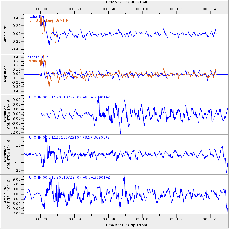
JOHN Johnston Island, USA - Earthquake Result Viewer
*The percent match for this event was below the threshold and hence no stack was calculated.
| Earthquake location: |
South Of Fiji Islands |
| Earthquake latitude/longitude: |
-23.8/179.8 |
| Earthquake time(UTC): |
2011/07/29 (210) 07:42:22 GMT |
| Earthquake Depth: |
523 km |
| Earthquake Magnitude: |
6.2 MB, 6.7 MW, 6.7 MW |
| Earthquake Catalog/Contributor: |
WHDF/NEIC |
|
| Network: |
IU Global Seismograph Network (GSN - IRIS/USGS) |
| Station: |
JOHN Johnston Island, USA |
| Lat/Lon: |
16.73 N/169.53 W |
| Elevation: |
2.0 m |
|
| Distance: |
41.6 deg |
| Az: |
15.557 deg |
| Baz: |
194.857 deg |
| Ray Param: |
$rayparam |
*The percent match for this event was below the threshold and hence was not used in the summary stack. |
|
| Radial Match: |
71.65462 % |
| Radial Bump: |
400 |
| Transverse Match: |
45.27503 % |
| Transverse Bump: |
392 |
| SOD ConfigId: |
558545 |
| Insert Time: |
2013-09-18 23:47:13.049 +0000 |
| GWidth: |
2.5 |
| Max Bumps: |
400 |
| Tol: |
0.001 |
|
Signal To Noise
| Channel | StoN | STA | LTA |
| IU:JOHN:00:BHZ:20110729T07:48:54.369014Z | 10.397429 | 1.008094E-5 | 9.695608E-7 |
| IU:JOHN:00:BH1:20110729T07:48:54.369014Z | 2.4377146 | 3.7686125E-6 | 1.5459613E-6 |
| IU:JOHN:00:BH2:20110729T07:48:54.369014Z | 2.7749655 | 4.571914E-6 | 1.6475569E-6 |
| Arrivals |
| Ps | |
| PpPs | |
| PsPs/PpSs | |


