You are here: Home > Network List > US - United States National Seismic Network Stations List
> Station MSO Missoula, Montana, USA > Earthquake Result Viewer
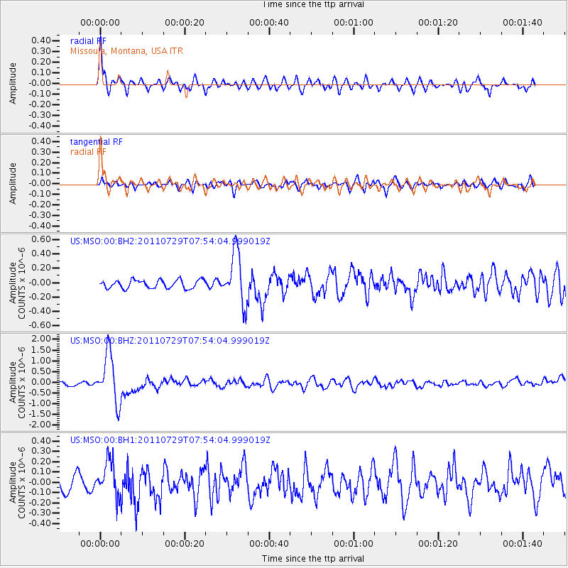
MSO Missoula, Montana, USA - Earthquake Result Viewer
*The percent match for this event was below the threshold and hence no stack was calculated.
| Earthquake location: |
South Of Fiji Islands |
| Earthquake latitude/longitude: |
-23.8/179.8 |
| Earthquake time(UTC): |
2011/07/29 (210) 07:42:22 GMT |
| Earthquake Depth: |
523 km |
| Earthquake Magnitude: |
6.2 MB, 6.7 MW, 6.7 MW |
| Earthquake Catalog/Contributor: |
WHDF/NEIC |
|
| Network: |
US United States National Seismic Network |
| Station: |
MSO Missoula, Montana, USA |
| Lat/Lon: |
46.83 N/113.94 W |
| Elevation: |
1264 m |
|
| Distance: |
92.2 deg |
| Az: |
38.99 deg |
| Baz: |
237.08 deg |
| Ray Param: |
$rayparam |
*The percent match for this event was below the threshold and hence was not used in the summary stack. |
|
| Radial Match: |
74.725586 % |
| Radial Bump: |
400 |
| Transverse Match: |
65.90661 % |
| Transverse Bump: |
400 |
| SOD ConfigId: |
558545 |
| Insert Time: |
2013-09-18 23:48:25.800 +0000 |
| GWidth: |
2.5 |
| Max Bumps: |
400 |
| Tol: |
0.001 |
|
Signal To Noise
| Channel | StoN | STA | LTA |
| US:MSO:00:BHZ:20110729T07:54:04.999019Z | 18.166819 | 1.1780331E-6 | 6.4845324E-8 |
| US:MSO:00:BH1:20110729T07:54:04.999019Z | 2.7168345 | 1.8050581E-7 | 6.643975E-8 |
| US:MSO:00:BH2:20110729T07:54:04.999019Z | 6.4774785 | 3.7178208E-7 | 5.7396115E-8 |
| Arrivals |
| Ps | |
| PpPs | |
| PsPs/PpSs | |


