KAPI Kappang, Sulawesi, Indonesia - Earthquake Result Viewer
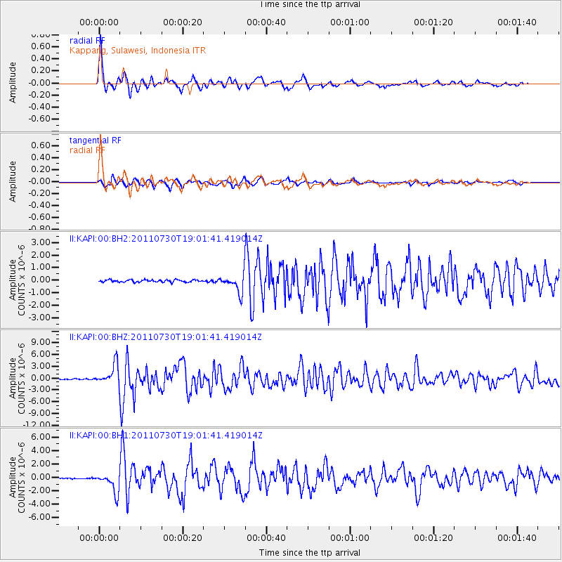
Earthquake location: Near East Coast Of Honshu, Japan
Earthquake latitude/longitude: 36.9/141.0
Earthquake time(UTC): 2011/07/30 (211) 18:53:49 GMT
Earthquake Depth: 30 km
Earthquake Magnitude: 6.4 MB, 6.0 MS, 6.5 MW, 6.4 MW
Earthquake Catalog/Contributor: WHDF/NEIC
Network: II Global Seismograph Network (GSN - IRIS/IDA)
Station: KAPI Kappang, Sulawesi, Indonesia
Lat/Lon: 5.01 S/119.75 E
Elevation: 300 m
Distance: 46.2 deg
Az: 209.953 deg
Baz: 23.674 deg
Ray Param: 0.07073685
Estimated Moho Depth: 36.5 km
Estimated Crust Vp/Vs: 1.75
Assumed Crust Vp: 6.343 km/s
Estimated Crust Vs: 3.635 km/s
Estimated Crust Poisson's Ratio: 0.26
Radial Match: 95.148895 %
Radial Bump: 400
Transverse Match: 90.19495 %
Transverse Bump: 400
SOD ConfigId: 558545
Insert Time: 2013-09-18 23:51:04.433 +0000
GWidth: 2.5
Max Bumps: 400
Tol: 0.001

Signal To Noise

ChannelStoNSTALTA
II:KAPI:00:BHZ:20110730T19:01:41.419014Z22.993732.665447E-61.159206E-7
II:KAPI:00:BH1:20110730T19:01:41.419014Z24.357811.5037045E-66.173398E-8
II:KAPI:00:BH2:20110730T19:01:41.419014Z7.38280446.655094E-79.014317E-8
Arrivals
Ps4.6 SECOND
PpPs15 SECOND
PsPs/PpSs19 SECOND