
KEV Kevo, Finland - Earthquake Result Viewer
| ||||||||||||||||||
| ||||||||||||||||||
| ||||||||||||||||||
|
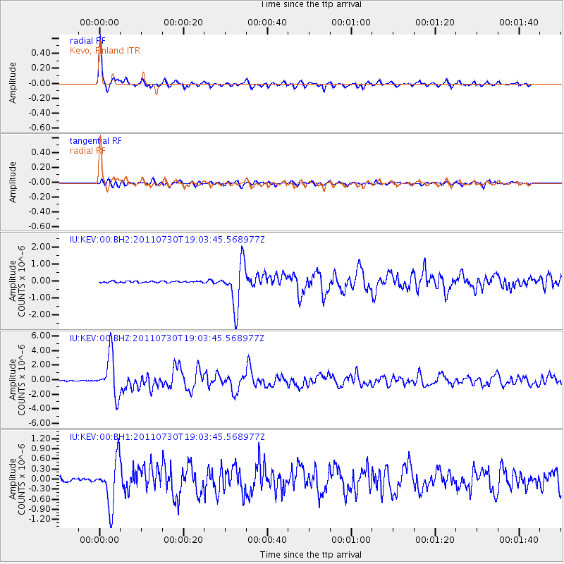
Signal To Noise
| Channel | StoN | STA | LTA |
| IU:KEV:00:BHZ:20110730T19:03:45.568977Z | 37.036495 | 2.8898512E-6 | 7.802712E-8 |
| IU:KEV:00:BH1:20110730T19:03:45.568977Z | 13.00979 | 7.091901E-7 | 5.4512032E-8 |
| IU:KEV:00:BH2:20110730T19:03:45.568977Z | 33.31708 | 1.3331968E-6 | 4.0015415E-8 |
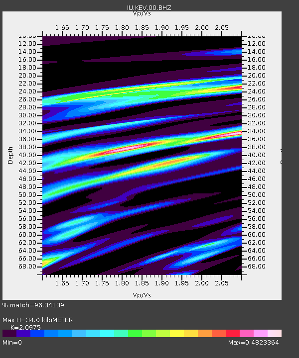
| Arrivals | |
| Ps | 5.9 SECOND |
| PpPs | 15 SECOND |
| PsPs/PpSs | 21 SECOND |

