You are here: Home > Network List > US - United States National Seismic Network Stations List
> Station AMTX Amarillo, Texas, USA > Earthquake Result Viewer
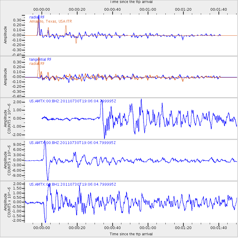
AMTX Amarillo, Texas, USA - Earthquake Result Viewer
*The percent match for this event was below the threshold and hence no stack was calculated.
| Earthquake location: |
Near East Coast Of Honshu, Japan |
| Earthquake latitude/longitude: |
36.9/141.0 |
| Earthquake time(UTC): |
2011/07/30 (211) 18:53:49 GMT |
| Earthquake Depth: |
30 km |
| Earthquake Magnitude: |
6.4 MB, 6.0 MS, 6.5 MW, 6.4 MW |
| Earthquake Catalog/Contributor: |
WHDF/NEIC |
|
| Network: |
US United States National Seismic Network |
| Station: |
AMTX Amarillo, Texas, USA |
| Lat/Lon: |
34.53 N/101.41 W |
| Elevation: |
1010 m |
|
| Distance: |
88.2 deg |
| Az: |
47.036 deg |
| Baz: |
314.755 deg |
| Ray Param: |
$rayparam |
*The percent match for this event was below the threshold and hence was not used in the summary stack. |
|
| Radial Match: |
96.07791 % |
| Radial Bump: |
400 |
| Transverse Match: |
87.30179 % |
| Transverse Bump: |
400 |
| SOD ConfigId: |
558545 |
| Insert Time: |
2013-09-18 23:52:40.448 +0000 |
| GWidth: |
2.5 |
| Max Bumps: |
400 |
| Tol: |
0.001 |
|
Signal To Noise
| Channel | StoN | STA | LTA |
| US:AMTX:00:BHZ:20110730T19:06:04.799995Z | 51.898663 | 6.2617632E-6 | 1.2065365E-7 |
| US:AMTX:00:BH1:20110730T19:06:04.799995Z | 14.966883 | 1.2394505E-6 | 8.2812875E-8 |
| US:AMTX:00:BH2:20110730T19:06:04.799995Z | 16.911444 | 1.285651E-6 | 7.6022545E-8 |
| Arrivals |
| Ps | |
| PpPs | |
| PsPs/PpSs | |


