
EGMT Eagleton, Montana, USA - Earthquake Result Viewer
| ||||||||||||||||||
| ||||||||||||||||||
| ||||||||||||||||||
|
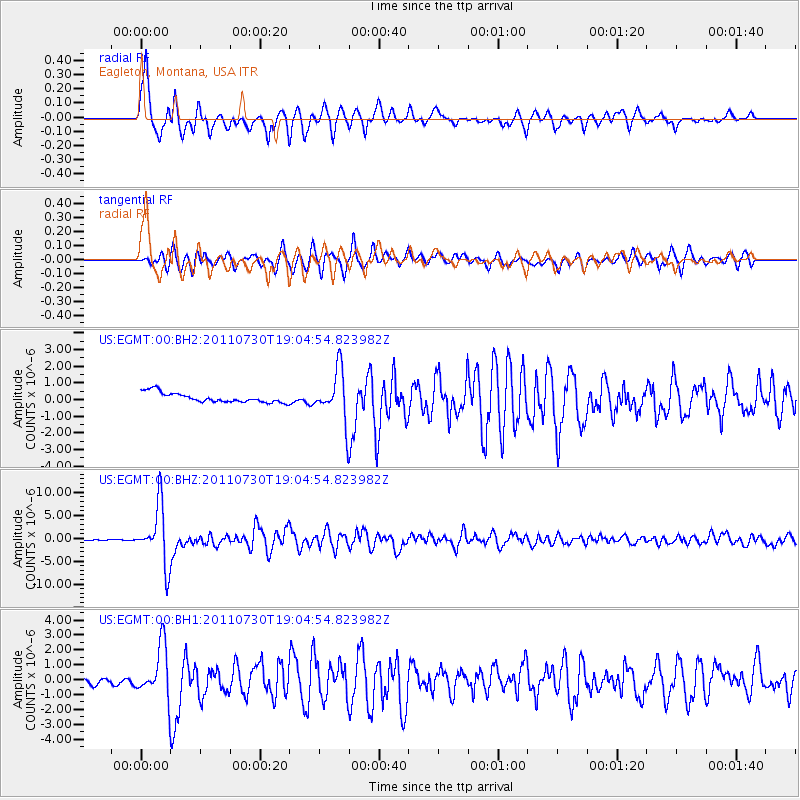
Signal To Noise
| Channel | StoN | STA | LTA |
| US:EGMT:00:BHZ:20110730T19:04:54.823982Z | 81.61531 | 6.470936E-6 | 7.928581E-8 |
| US:EGMT:00:BH1:20110730T19:04:54.823982Z | 8.127913 | 1.7382969E-6 | 2.1386755E-7 |
| US:EGMT:00:BH2:20110730T19:04:54.823982Z | 4.7363367 | 1.3761772E-6 | 2.905573E-7 |
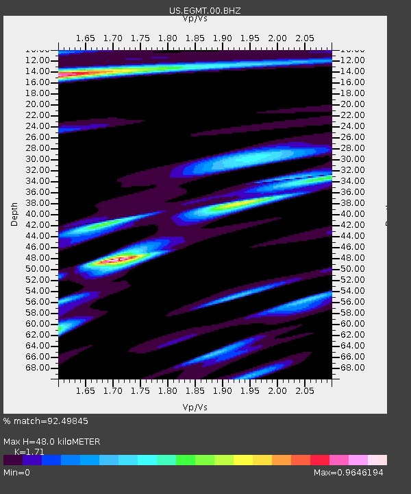
| Arrivals | |
| Ps | 5.5 SECOND |
| PpPs | 20 SECOND |
| PsPs/PpSs | 25 SECOND |

