GLMI Grayling, Michigan, USA - Earthquake Result Viewer
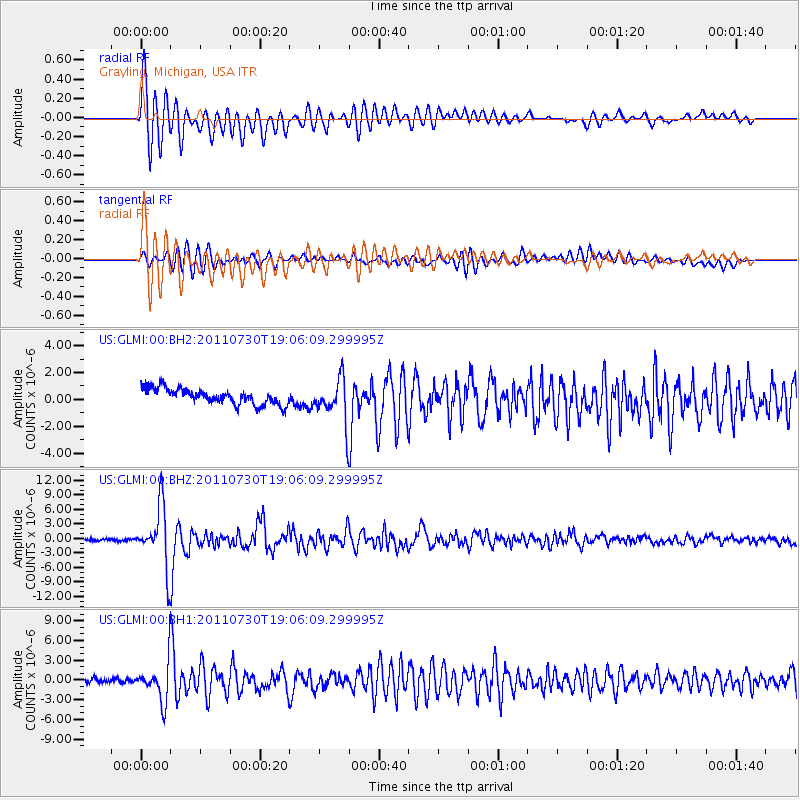
Earthquake location: Near East Coast Of Honshu, Japan
Earthquake latitude/longitude: 36.9/141.0
Earthquake time(UTC): 2011/07/30 (211) 18:53:49 GMT
Earthquake Depth: 30 km
Earthquake Magnitude: 6.4 MB, 6.0 MS, 6.5 MW, 6.4 MW
Earthquake Catalog/Contributor: WHDF/NEIC
Network: US United States National Seismic Network
Station: GLMI Grayling, Michigan, USA
Lat/Lon: 44.82 N/84.62 W
Elevation: 387 m
Distance: 88.8 deg
Az: 30.554 deg
Baz: 325.088 deg
Ray Param: 0.04229808
Estimated Moho Depth: 29.0 km
Estimated Crust Vp/Vs: 1.91
Assumed Crust Vp: 6.483 km/s
Estimated Crust Vs: 3.394 km/s
Estimated Crust Poisson's Ratio: 0.31
Radial Match: 91.0186 %
Radial Bump: 400
Transverse Match: 81.75447 %
Transverse Bump: 400
SOD ConfigId: 558545
Insert Time: 2013-09-18 23:53:20.357 +0000
GWidth: 2.5
Max Bumps: 400
Tol: 0.001

Signal To Noise

ChannelStoNSTALTA
US:GLMI:00:BHZ:20110730T19:06:09.299995Z30.378816.3556045E-62.0921176E-7
US:GLMI:00:BH1:20110730T19:06:09.299995Z7.8649673.0430726E-63.8691488E-7
US:GLMI:00:BH2:20110730T19:06:09.299995Z2.5730821.4856935E-65.7739845E-7
Arrivals
Ps4.2 SECOND
PpPs13 SECOND
PsPs/PpSs17 SECOND