
KSU1 Kansas State University--Konza Prairie, Kansas, USA - Earthquake Result Viewer
| ||||||||||||||||||
| ||||||||||||||||||
| ||||||||||||||||||
|
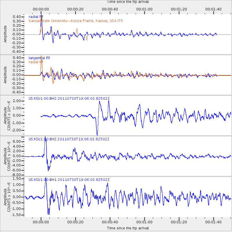
Signal To Noise
| Channel | StoN | STA | LTA |
| US:KSU1:00:BHZ:20110730T19:06:03.82502Z | 40.85166 | 3.8591966E-6 | 9.446853E-8 |
| US:KSU1:00:BH1:20110730T19:06:03.82502Z | 12.465504 | 7.741424E-7 | 6.210278E-8 |
| US:KSU1:00:BH2:20110730T19:06:03.82502Z | 13.7434 | 1.2274847E-6 | 8.931449E-8 |
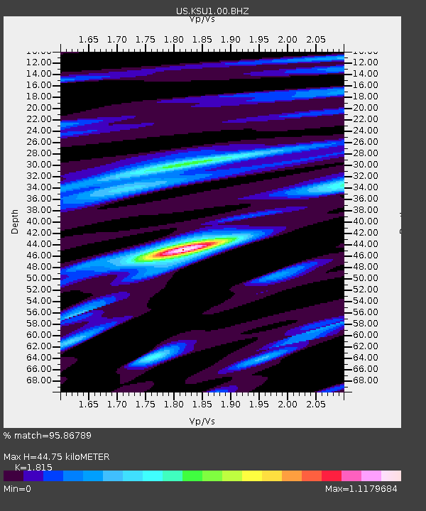
| Arrivals | |
| Ps | 5.8 SECOND |
| PpPs | 19 SECOND |
| PsPs/PpSs | 25 SECOND |

