LAO LASA Array, Montana, USA - Earthquake Result Viewer
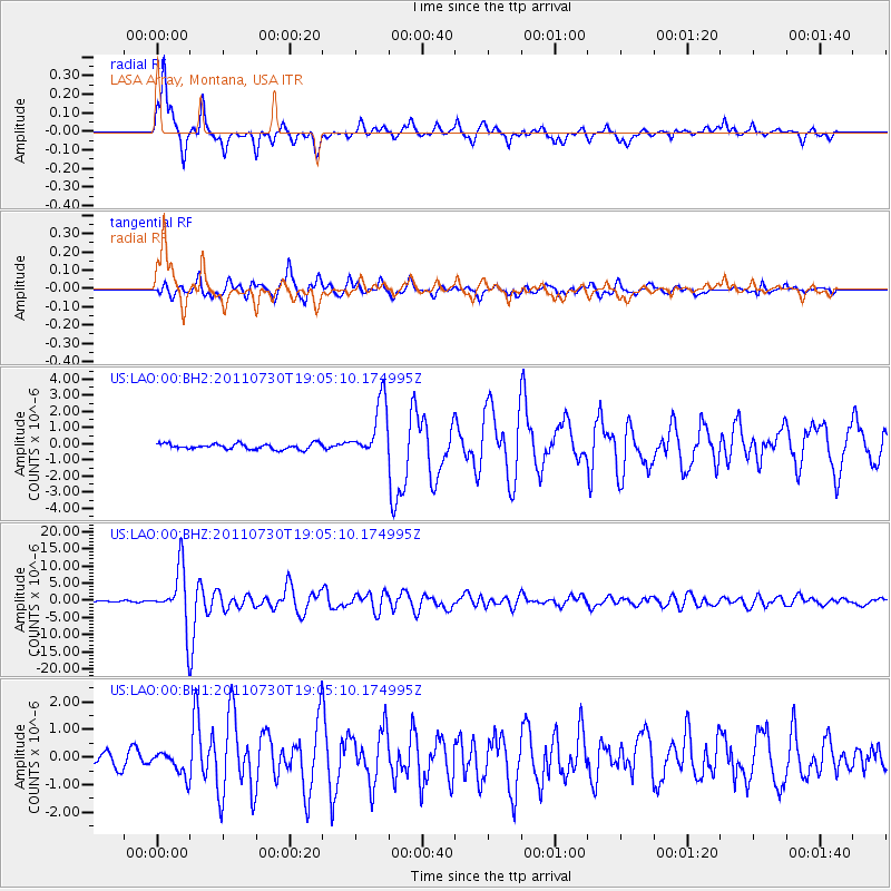
Earthquake location: Near East Coast Of Honshu, Japan
Earthquake latitude/longitude: 36.9/141.0
Earthquake time(UTC): 2011/07/30 (211) 18:53:49 GMT
Earthquake Depth: 30 km
Earthquake Magnitude: 6.4 MB, 6.0 MS, 6.5 MW, 6.4 MW
Earthquake Catalog/Contributor: WHDF/NEIC
Network: US United States National Seismic Network
Station: LAO LASA Array, Montana, USA
Lat/Lon: 46.69 N/106.22 W
Elevation: 902 m
Distance: 77.3 deg
Az: 40.579 deg
Baz: 310.795 deg
Ray Param: 0.050389636
Estimated Moho Depth: 41.5 km
Estimated Crust Vp/Vs: 2.03
Assumed Crust Vp: 6.438 km/s
Estimated Crust Vs: 3.175 km/s
Estimated Crust Poisson's Ratio: 0.34
Radial Match: 95.224174 %
Radial Bump: 333
Transverse Match: 89.95452 %
Transverse Bump: 400
SOD ConfigId: 558545
Insert Time: 2013-09-18 23:53:40.194 +0000
GWidth: 2.5
Max Bumps: 400
Tol: 0.001

Signal To Noise

ChannelStoNSTALTA
US:LAO:00:BHZ:20110730T19:05:10.174995Z45.0676278.457762E-61.8766825E-7
US:LAO:00:BH1:20110730T19:05:10.174995Z1.91827854.409915E-72.298892E-7
US:LAO:00:BH2:20110730T19:05:10.174995Z10.1859021.7787871E-61.7463226E-7
Arrivals
Ps6.8 SECOND
PpPs19 SECOND
PsPs/PpSs26 SECOND