
MIAR Mount Ida, Arkansas, USA - Earthquake Result Viewer
| ||||||||||||||||||
| ||||||||||||||||||
| ||||||||||||||||||
|
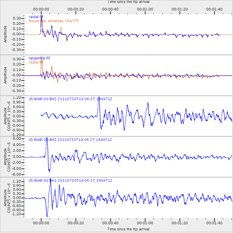
Signal To Noise
| Channel | StoN | STA | LTA |
| US:MIAR:00:BHZ:20110730T19:06:27.149971Z | 35.971367 | 2.7931196E-6 | 7.7648416E-8 |
| US:MIAR:00:BH1:20110730T19:06:27.149971Z | 8.241535 | 5.2584306E-7 | 6.380402E-8 |
| US:MIAR:00:BH2:20110730T19:06:27.149971Z | 4.9634805 | 4.8685365E-7 | 9.8087156E-8 |
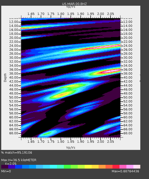
| Arrivals | |
| Ps | 6.0 SECOND |
| PpPs | 17 SECOND |
| PsPs/PpSs | 23 SECOND |

