
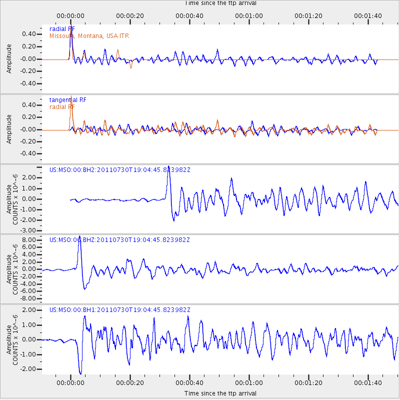
MSO Missoula, Montana, USA - Earthquake Result Viewer
| ||||||||||||||||||
| ||||||||||||||||||
| ||||||||||||||||||
|
Signal To Noise
| Channel | StoN | STA | LTA |
| US:MSO:00:BHZ:20110730T19:04:45.823982Z | 32.08333 | 3.8700473E-6 | 1.2062488E-7 |
| US:MSO:00:BH1:20110730T19:04:45.823982Z | 15.703793 | 1.0934832E-6 | 6.963179E-8 |
| US:MSO:00:BH2:20110730T19:04:45.823982Z | 19.141048 | 1.3265011E-6 | 6.9301386E-8 |
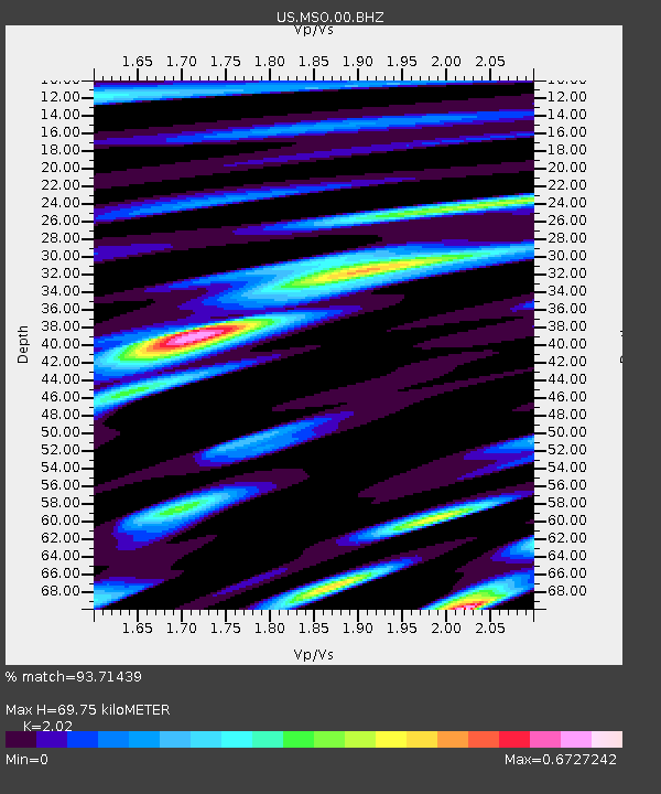
| Arrivals | |
| Ps | 12 SECOND |
| PpPs | 32 SECOND |
| PsPs/PpSs | 44 SECOND |

