NLWA Neilton Lookout, Washington, USA - Earthquake Result Viewer
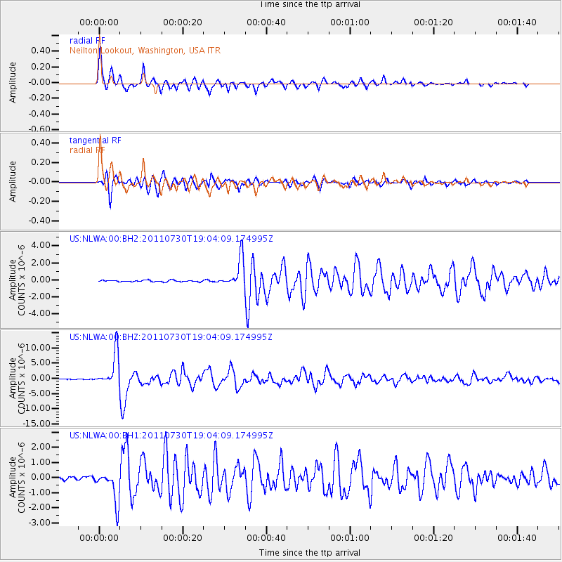
Earthquake location: Near East Coast Of Honshu, Japan
Earthquake latitude/longitude: 36.9/141.0
Earthquake time(UTC): 2011/07/30 (211) 18:53:49 GMT
Earthquake Depth: 30 km
Earthquake Magnitude: 6.4 MB, 6.0 MS, 6.5 MW, 6.4 MW
Earthquake Catalog/Contributor: WHDF/NEIC
Network: US United States National Seismic Network
Station: NLWA Neilton Lookout, Washington, USA
Lat/Lon: 47.39 N/123.87 W
Elevation: 640 m
Distance: 67.0 deg
Az: 47.297 deg
Baz: 299.942 deg
Ray Param: 0.057168853
Estimated Moho Depth: 63.25 km
Estimated Crust Vp/Vs: 2.07
Assumed Crust Vp: 6.566 km/s
Estimated Crust Vs: 3.172 km/s
Estimated Crust Poisson's Ratio: 0.35
Radial Match: 95.27823 %
Radial Bump: 327
Transverse Match: 93.804886 %
Transverse Bump: 400
SOD ConfigId: 558545
Insert Time: 2013-09-18 23:54:08.048 +0000
GWidth: 2.5
Max Bumps: 400
Tol: 0.001

Signal To Noise

ChannelStoNSTALTA
US:NLWA:00:BHZ:20110730T19:04:09.174995Z50.2656675.686826E-61.1313539E-7
US:NLWA:00:BH1:20110730T19:04:09.174995Z10.0204211.0940727E-61.091843E-7
US:NLWA:00:BH2:20110730T19:04:09.174995Z21.2724021.8112057E-68.5143455E-8
Arrivals
Ps11 SECOND
PpPs29 SECOND
PsPs/PpSs39 SECOND