SCIA State Center, Iowa, USA - Earthquake Result Viewer
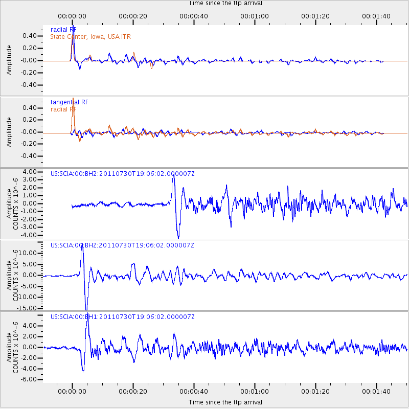
Earthquake location: Near East Coast Of Honshu, Japan
Earthquake latitude/longitude: 36.9/141.0
Earthquake time(UTC): 2011/07/30 (211) 18:53:49 GMT
Earthquake Depth: 30 km
Earthquake Magnitude: 6.4 MB, 6.0 MS, 6.5 MW, 6.4 MW
Earthquake Catalog/Contributor: WHDF/NEIC
Network: US United States National Seismic Network
Station: SCIA State Center, Iowa, USA
Lat/Lon: 41.91 N/93.22 W
Elevation: 312 m
Distance: 87.2 deg
Az: 37.296 deg
Baz: 319.433 deg
Ray Param: 0.043429743
Estimated Moho Depth: 44.75 km
Estimated Crust Vp/Vs: 1.60
Assumed Crust Vp: 6.498 km/s
Estimated Crust Vs: 4.061 km/s
Estimated Crust Poisson's Ratio: 0.18
Radial Match: 96.41552 %
Radial Bump: 287
Transverse Match: 85.76995 %
Transverse Bump: 400
SOD ConfigId: 558545
Insert Time: 2013-09-18 23:54:23.925 +0000
GWidth: 2.5
Max Bumps: 400
Tol: 0.001

Signal To Noise

ChannelStoNSTALTA
US:SCIA:00:BHZ:20110730T19:06:02.000007Z69.330967.3347755E-61.0579365E-7
US:SCIA:00:BH1:20110730T19:06:02.000007Z9.1026592.0695998E-62.273621E-7
US:SCIA:00:BH2:20110730T19:06:02.000007Z10.0909651.7099201E-61.694506E-7
Arrivals
Ps4.2 SECOND
PpPs17 SECOND
PsPs/PpSs22 SECOND