TPNV Topopah Spring, Nevada, USA - Earthquake Result Viewer
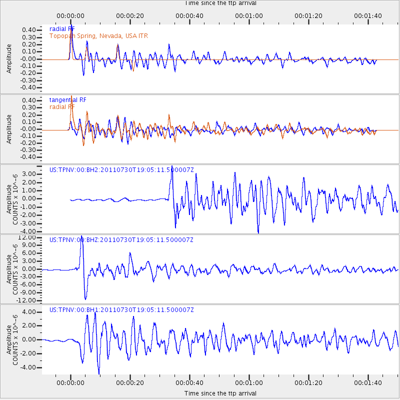
Earthquake location: Near East Coast Of Honshu, Japan
Earthquake latitude/longitude: 36.9/141.0
Earthquake time(UTC): 2011/07/30 (211) 18:53:49 GMT
Earthquake Depth: 30 km
Earthquake Magnitude: 6.4 MB, 6.0 MS, 6.5 MW, 6.4 MW
Earthquake Catalog/Contributor: WHDF/NEIC
Network: US United States National Seismic Network
Station: TPNV Topopah Spring, Nevada, USA
Lat/Lon: 36.95 N/116.25 W
Elevation: 1600 m
Distance: 77.5 deg
Az: 53.142 deg
Baz: 306.852 deg
Ray Param: 0.05022593
Estimated Moho Depth: 48.0 km
Estimated Crust Vp/Vs: 2.10
Assumed Crust Vp: 6.279 km/s
Estimated Crust Vs: 2.997 km/s
Estimated Crust Poisson's Ratio: 0.35
Radial Match: 93.17708 %
Radial Bump: 400
Transverse Match: 91.24528 %
Transverse Bump: 400
SOD ConfigId: 558545
Insert Time: 2013-09-18 23:54:29.420 +0000
GWidth: 2.5
Max Bumps: 400
Tol: 0.001

Signal To Noise

ChannelStoNSTALTA
US:TPNV:00:BHZ:20110730T19:05:11.500007Z47.5265585.161851E-61.08609825E-7
US:TPNV:00:BH1:20110730T19:05:11.500007Z12.3494841.2594968E-61.019878E-7
US:TPNV:00:BH2:20110730T19:05:11.500007Z13.4984091.2935435E-69.582933E-8
Arrivals
Ps8.6 SECOND
PpPs23 SECOND
PsPs/PpSs32 SECOND