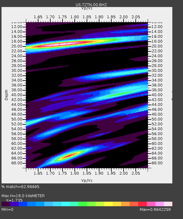
TZTN Tazewell, Tennessee, USA - Earthquake Result Viewer
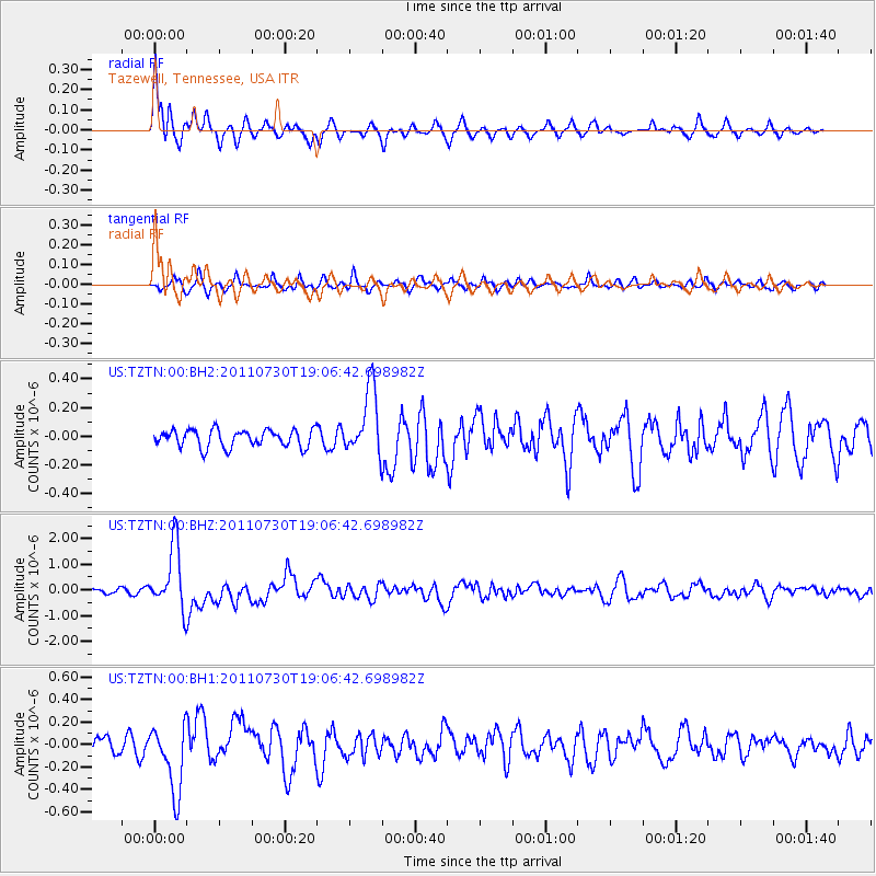
Earthquake location: Near East Coast Of Honshu, Japan
Earthquake latitude/longitude: 36.9/141.0
Earthquake time(UTC): 2011/07/30 (211) 18:53:49 GMT
Earthquake Depth: 30 km
Earthquake Magnitude: 6.4 MB, 6.0 MS, 6.5 MW, 6.4 MW
Earthquake Catalog/Contributor: WHDF/NEIC
Network: US United States National Seismic Network
Station: TZTN Tazewell, Tennessee, USA
Lat/Lon: 36.54 N/83.55 W
Elevation: 394 m
Distance: 96.0 deg
Az: 34.589 deg
Baz: 325.614 deg
Ray Param: 0.04060847
Estimated Moho Depth: 19.0 km
Estimated Crust Vp/Vs: 1.74
Assumed Crust Vp: 6.476 km/s
Estimated Crust Vs: 3.733 km/s
Estimated Crust Poisson's Ratio: 0.25
Radial Match: 82.96665 %
Radial Bump: 400
Transverse Match: 80.75606 %
Transverse Bump: 400
SOD ConfigId: 558545
Insert Time: 2013-09-18 23:54:30.370 +0000
GWidth: 2.5
Max Bumps: 400
Tol: 0.001

Signal To Noise

ChannelStoNSTALTA
US:TZTN:00:BHZ:20110730T19:06:42.698982Z15.8986011.249846E-67.861359E-8
US:TZTN:00:BH1:20110730T19:06:42.698982Z4.58157063.007893E-76.565201E-8
US:TZTN:00:BH2:20110730T19:06:42.698982Z3.81492022.3170004E-76.073523E-8
Arrivals
Ps2.2 SECOND
PpPs7.9 SECOND
PsPs/PpSs10 SECOND