You are here: Home > Network List > US - United States National Seismic Network Stations List
> Station CBKS Cedar Bluff, Kansas, USA > Earthquake Result Viewer
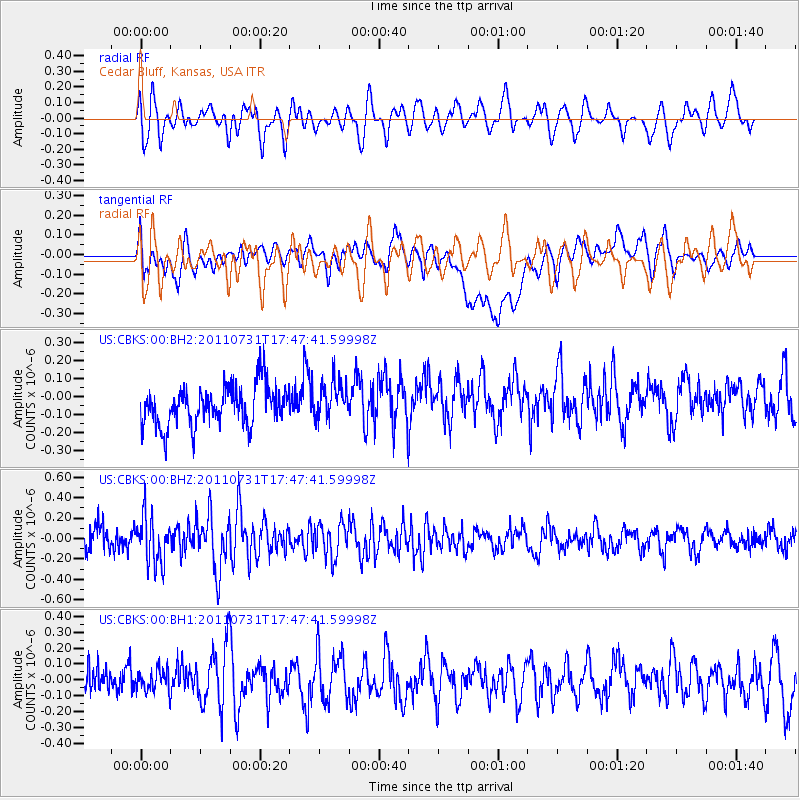
CBKS Cedar Bluff, Kansas, USA - Earthquake Result Viewer
*The percent match for this event was below the threshold and hence no stack was calculated.
| Earthquake location: |
Hokkaido, Japan Region |
| Earthquake latitude/longitude: |
41.8/142.8 |
| Earthquake time(UTC): |
2011/07/31 (212) 17:35:57 GMT |
| Earthquake Depth: |
32 km |
| Earthquake Magnitude: |
5.5 MB |
| Earthquake Catalog/Contributor: |
NEIC PDE/NEIC PDE-M |
|
| Network: |
US United States National Seismic Network |
| Station: |
CBKS Cedar Bluff, Kansas, USA |
| Lat/Lon: |
38.81 N/99.74 W |
| Elevation: |
677 m |
|
| Distance: |
81.6 deg |
| Az: |
44.491 deg |
| Baz: |
317.874 deg |
| Ray Param: |
$rayparam |
*The percent match for this event was below the threshold and hence was not used in the summary stack. |
|
| Radial Match: |
52.83295 % |
| Radial Bump: |
400 |
| Transverse Match: |
38.37114 % |
| Transverse Bump: |
400 |
| SOD ConfigId: |
558545 |
| Insert Time: |
2013-09-18 23:59:24.319 +0000 |
| GWidth: |
2.5 |
| Max Bumps: |
400 |
| Tol: |
0.001 |
|
Signal To Noise
| Channel | StoN | STA | LTA |
| US:CBKS:00:BHZ:20110731T17:47:41.59998Z | 1.7203176 | 2.3195693E-7 | 1.3483378E-7 |
| US:CBKS:00:BH1:20110731T17:47:41.59998Z | 0.4573885 | 7.334162E-8 | 1.6034862E-7 |
| US:CBKS:00:BH2:20110731T17:47:41.59998Z | 0.93838453 | 1.0257559E-7 | 1.09310825E-7 |
| Arrivals |
| Ps | |
| PpPs | |
| PsPs/PpSs | |


