You are here: Home > Network List > US - United States National Seismic Network Stations List
> Station NEW Newport, Washington, USA > Earthquake Result Viewer
NEW Newport, Washington, USA - Earthquake Result Viewer
*The percent match for this event was below the threshold and hence no stack was calculated.
| Earthquake location: |
Hokkaido, Japan Region |
| Earthquake latitude/longitude: |
41.8/142.8 |
| Earthquake time(UTC): |
2011/07/31 (212) 17:35:57 GMT |
| Earthquake Depth: |
32 km |
| Earthquake Magnitude: |
5.5 MB |
| Earthquake Catalog/Contributor: |
NEIC PDE/NEIC PDE-M |
|
| Network: |
US United States National Seismic Network |
| Station: |
NEW Newport, Washington, USA |
| Lat/Lon: |
48.26 N/117.12 W |
| Elevation: |
760 m |
|
| Distance: |
66.0 deg |
| Az: |
46.072 deg |
| Baz: |
306.297 deg |
| Ray Param: |
$rayparam |
*The percent match for this event was below the threshold and hence was not used in the summary stack. |
|
| Radial Match: |
56.601337 % |
| Radial Bump: |
400 |
| Transverse Match: |
61.161995 % |
| Transverse Bump: |
400 |
| SOD ConfigId: |
558545 |
| Insert Time: |
2013-09-19 00:00:39.263 +0000 |
| GWidth: |
2.5 |
| Max Bumps: |
400 |
| Tol: |
0.001 |
|
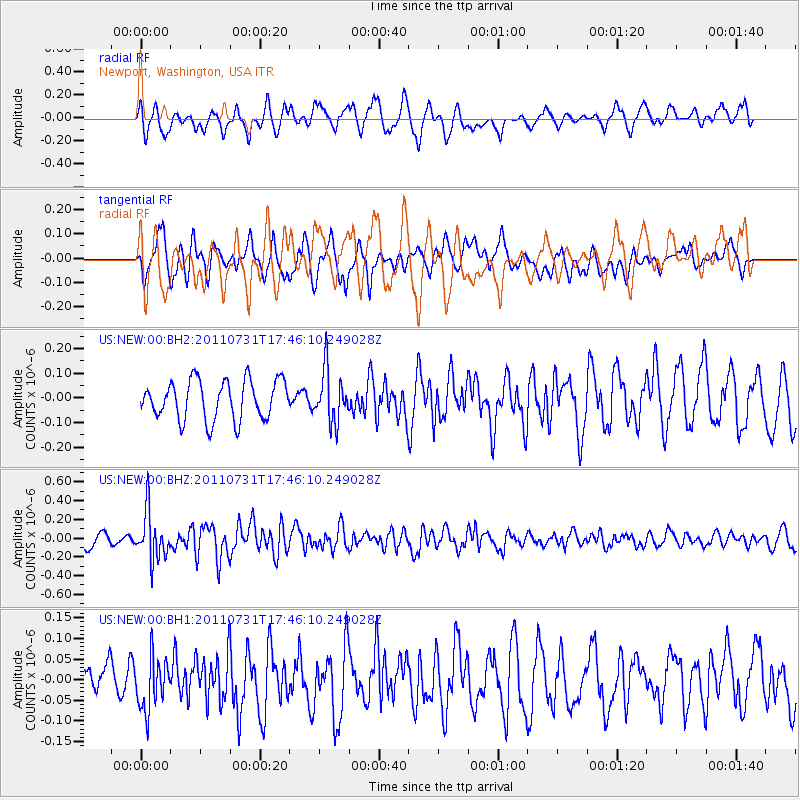
Signal To Noise
| Channel | StoN | STA | LTA |
| US:NEW:00:BHZ:20110731T17:46:10.249028Z | 3.7106075 | 2.5378426E-7 | 6.839426E-8 |
| US:NEW:00:BH1:20110731T17:46:10.249028Z | 0.81163687 | 6.44806E-8 | 7.944513E-8 |
| US:NEW:00:BH2:20110731T17:46:10.249028Z | 1.3105276 | 1.0335801E-7 | 7.886749E-8 |
| Arrivals |
| Ps | |
| PpPs | |
| PsPs/PpSs | |


