
MAKZ Makanchi, Kazakhstan - Earthquake Result Viewer
| ||||||||||||||||||
| ||||||||||||||||||
| ||||||||||||||||||
|
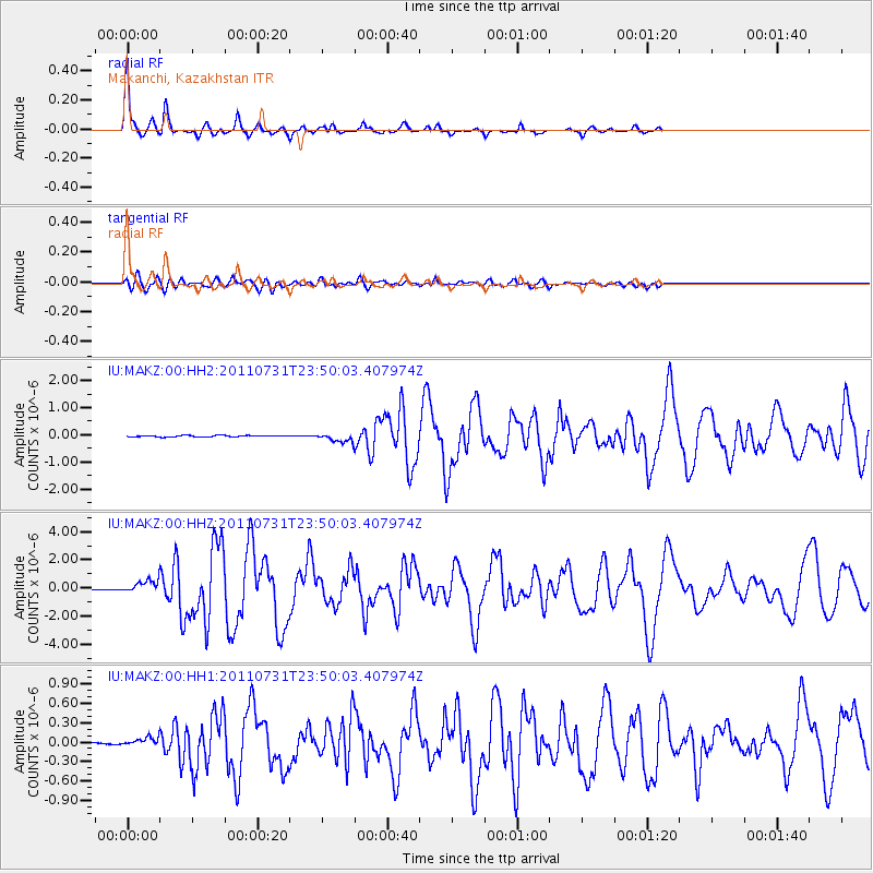
Signal To Noise
| Channel | StoN | STA | LTA |
| IU:MAKZ:00:HHZ:20110731T23:50:03.407974Z | 10.660043 | 4.3491644E-7 | 4.0798753E-8 |
| IU:MAKZ:00:HH1:20110731T23:50:03.407974Z | 2.3603344 | 6.14034E-8 | 2.6014702E-8 |
| IU:MAKZ:00:HH2:20110731T23:50:03.407974Z | 5.6995735 | 1.5545115E-7 | 2.7274172E-8 |
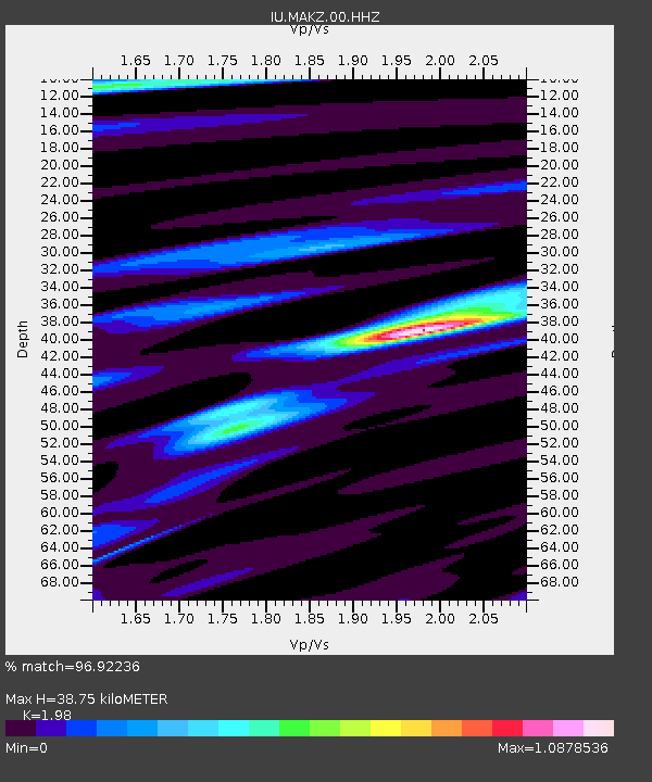
| Arrivals | |
| Ps | 6.0 SECOND |
| PpPs | 17 SECOND |
| PsPs/PpSs | 23 SECOND |

