INK INUVIK, N.W.T. - Earthquake Result Viewer
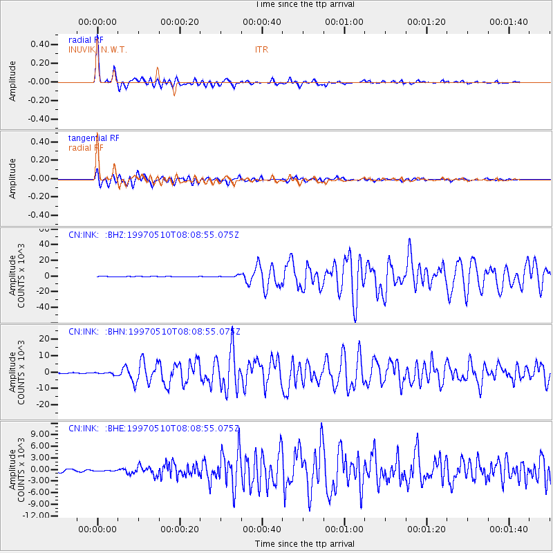
Earthquake location: Northern And Central Iran
Earthquake latitude/longitude: 33.8/59.8
Earthquake time(UTC): 1997/05/10 (130) 07:57:29 GMT
Earthquake Depth: 10 km
Earthquake Magnitude: 6.4 MB, 7.3 MS, 7.5 UNKNOWN, 7.2 MW
Earthquake Catalog/Contributor: WHDF/NEIC
Network: CN Canadian National Seismograph Network
Station: INK INUVIK, N.W.T.
Lat/Lon: 68.31 N/133.52 W
Elevation: 40 m
Distance: 77.7 deg
Az: 5.033 deg
Baz: 348.671 deg
Ray Param: 0.050150976
Estimated Moho Depth: 28.25 km
Estimated Crust Vp/Vs: 1.88
Assumed Crust Vp: 6.171 km/s
Estimated Crust Vs: 3.274 km/s
Estimated Crust Poisson's Ratio: 0.30
Radial Match: 97.56737 %
Radial Bump: 393
Transverse Match: 93.59951 %
Transverse Bump: 400
SOD ConfigId: 6273
Insert Time: 2010-02-27 06:16:13.534 +0000
GWidth: 2.5
Max Bumps: 400
Tol: 0.001

Signal To Noise

ChannelStoNSTALTA
CN:INK: :BHN:19970510T08:08:55.075Z2.172245702.82806323.5492
CN:INK: :BHE:19970510T08:08:55.075Z0.31031933108.74527350.4302
CN:INK: :BHZ:19970510T08:08:55.075Z4.04526471235.2245305.3507
Arrivals
Ps4.2 SECOND
PpPs13 SECOND
PsPs/PpSs17 SECOND