You are here: Home > Network List > US - United States National Seismic Network Stations List
> Station DGMT Dagmar, Montana, USA > Earthquake Result Viewer
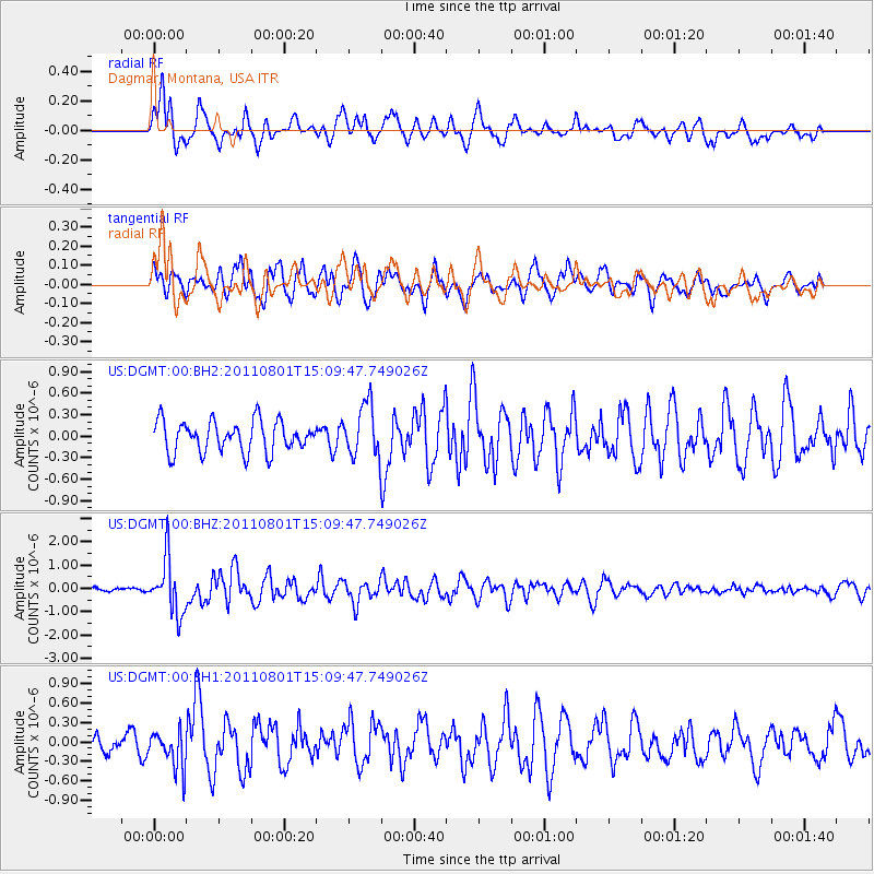
DGMT Dagmar, Montana, USA - Earthquake Result Viewer
*The percent match for this event was below the threshold and hence no stack was calculated.
| Earthquake location: |
Near S. Coast Of Honshu, Japan |
| Earthquake latitude/longitude: |
34.6/138.4 |
| Earthquake time(UTC): |
2011/08/01 (213) 14:58:09 GMT |
| Earthquake Depth: |
13 km |
| Earthquake Magnitude: |
6.0 MB, 5.6 MS, 5.9 MW, 5.9 MW |
| Earthquake Catalog/Contributor: |
WHDF/NEIC |
|
| Network: |
US United States National Seismic Network |
| Station: |
DGMT Dagmar, Montana, USA |
| Lat/Lon: |
48.47 N/104.20 W |
| Elevation: |
0.0 m |
|
| Distance: |
80.2 deg |
| Az: |
36.85 deg |
| Baz: |
312.004 deg |
| Ray Param: |
$rayparam |
*The percent match for this event was below the threshold and hence was not used in the summary stack. |
|
| Radial Match: |
67.08105 % |
| Radial Bump: |
400 |
| Transverse Match: |
70.40204 % |
| Transverse Bump: |
400 |
| SOD ConfigId: |
558545 |
| Insert Time: |
2013-09-19 00:09:27.683 +0000 |
| GWidth: |
2.5 |
| Max Bumps: |
400 |
| Tol: |
0.001 |
|
Signal To Noise
| Channel | StoN | STA | LTA |
| US:DGMT:00:BHZ:20110801T15:09:47.749026Z | 6.2904043 | 1.1643217E-6 | 1.8509489E-7 |
| US:DGMT:00:BH1:20110801T15:09:47.749026Z | 1.6211953 | 2.8754224E-7 | 1.7736433E-7 |
| US:DGMT:00:BH2:20110801T15:09:47.749026Z | 1.6759524 | 3.6339375E-7 | 2.168282E-7 |
| Arrivals |
| Ps | |
| PpPs | |
| PsPs/PpSs | |


