You are here: Home > Network List > US - United States National Seismic Network Stations List
> Station CBKS Cedar Bluff, Kansas, USA > Earthquake Result Viewer
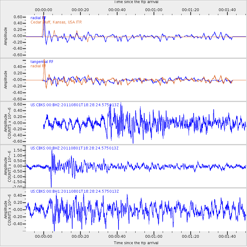
CBKS Cedar Bluff, Kansas, USA - Earthquake Result Viewer
*The percent match for this event was below the threshold and hence no stack was calculated.
| Earthquake location: |
Fox Islands, Aleutian Islands |
| Earthquake latitude/longitude: |
51.8/-171.3 |
| Earthquake time(UTC): |
2011/08/01 (213) 18:20:05 GMT |
| Earthquake Depth: |
41 km |
| Earthquake Magnitude: |
5.6 MW |
| Earthquake Catalog/Contributor: |
NEIC PDE/NEIC PDE-M |
|
| Network: |
US United States National Seismic Network |
| Station: |
CBKS Cedar Bluff, Kansas, USA |
| Lat/Lon: |
38.81 N/99.74 W |
| Elevation: |
677 m |
|
| Distance: |
50.0 deg |
| Az: |
75.349 deg |
| Baz: |
309.722 deg |
| Ray Param: |
$rayparam |
*The percent match for this event was below the threshold and hence was not used in the summary stack. |
|
| Radial Match: |
70.05302 % |
| Radial Bump: |
387 |
| Transverse Match: |
49.808056 % |
| Transverse Bump: |
400 |
| SOD ConfigId: |
558545 |
| Insert Time: |
2013-09-19 00:13:32.024 +0000 |
| GWidth: |
2.5 |
| Max Bumps: |
400 |
| Tol: |
0.001 |
|
Signal To Noise
| Channel | StoN | STA | LTA |
| US:CBKS:00:BHZ:20110801T18:28:24.575013Z | 5.2352724 | 5.2544056E-7 | 1.0036546E-7 |
| US:CBKS:00:BH1:20110801T18:28:24.575013Z | 1.8149844 | 1.5341291E-7 | 8.4525745E-8 |
| US:CBKS:00:BH2:20110801T18:28:24.575013Z | 1.6964546 | 1.8450388E-7 | 1.08758506E-7 |
| Arrivals |
| Ps | |
| PpPs | |
| PsPs/PpSs | |


