You are here: Home > Network List > US - United States National Seismic Network Stations List
> Station EGMT Eagleton, Montana, USA > Earthquake Result Viewer
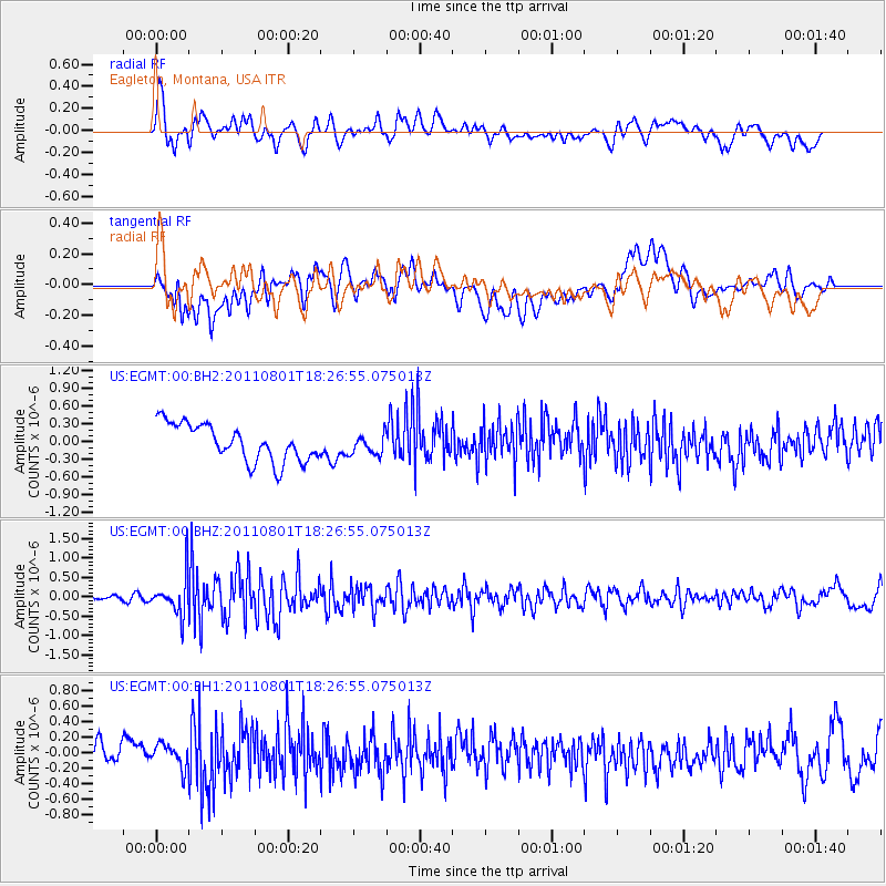
EGMT Eagleton, Montana, USA - Earthquake Result Viewer
*The percent match for this event was below the threshold and hence no stack was calculated.
| Earthquake location: |
Fox Islands, Aleutian Islands |
| Earthquake latitude/longitude: |
51.8/-171.3 |
| Earthquake time(UTC): |
2011/08/01 (213) 18:20:05 GMT |
| Earthquake Depth: |
41 km |
| Earthquake Magnitude: |
5.6 MW |
| Earthquake Catalog/Contributor: |
NEIC PDE/NEIC PDE-M |
|
| Network: |
US United States National Seismic Network |
| Station: |
EGMT Eagleton, Montana, USA |
| Lat/Lon: |
48.02 N/109.75 W |
| Elevation: |
1055 m |
|
| Distance: |
38.8 deg |
| Az: |
70.461 deg |
| Baz: |
299.318 deg |
| Ray Param: |
$rayparam |
*The percent match for this event was below the threshold and hence was not used in the summary stack. |
|
| Radial Match: |
63.65818 % |
| Radial Bump: |
400 |
| Transverse Match: |
38.397335 % |
| Transverse Bump: |
400 |
| SOD ConfigId: |
558545 |
| Insert Time: |
2013-09-19 00:13:50.001 +0000 |
| GWidth: |
2.5 |
| Max Bumps: |
400 |
| Tol: |
0.001 |
|
Signal To Noise
| Channel | StoN | STA | LTA |
| US:EGMT:00:BHZ:20110801T18:26:55.075013Z | 6.5198197 | 4.9319357E-7 | 7.5645275E-8 |
| US:EGMT:00:BH1:20110801T18:26:55.075013Z | 1.156351 | 1.5430246E-7 | 1.3343912E-7 |
| US:EGMT:00:BH2:20110801T18:26:55.075013Z | 0.5493125 | 1.714498E-7 | 3.1211707E-7 |
| Arrivals |
| Ps | |
| PpPs | |
| PsPs/PpSs | |


