You are here: Home > Network List > US - United States National Seismic Network Stations List
> Station LAO LASA Array, Montana, USA > Earthquake Result Viewer
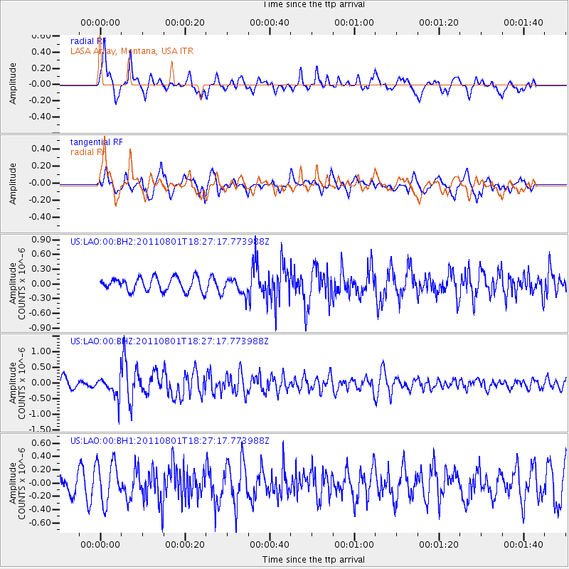
LAO LASA Array, Montana, USA - Earthquake Result Viewer
*The percent match for this event was below the threshold and hence no stack was calculated.
| Earthquake location: |
Fox Islands, Aleutian Islands |
| Earthquake latitude/longitude: |
51.8/-171.3 |
| Earthquake time(UTC): |
2011/08/01 (213) 18:20:05 GMT |
| Earthquake Depth: |
41 km |
| Earthquake Magnitude: |
5.6 MW |
| Earthquake Catalog/Contributor: |
NEIC PDE/NEIC PDE-M |
|
| Network: |
US United States National Seismic Network |
| Station: |
LAO LASA Array, Montana, USA |
| Lat/Lon: |
46.69 N/106.22 W |
| Elevation: |
902 m |
|
| Distance: |
41.5 deg |
| Az: |
70.35 deg |
| Baz: |
301.824 deg |
| Ray Param: |
$rayparam |
*The percent match for this event was below the threshold and hence was not used in the summary stack. |
|
| Radial Match: |
56.193047 % |
| Radial Bump: |
400 |
| Transverse Match: |
66.57922 % |
| Transverse Bump: |
400 |
| SOD ConfigId: |
558545 |
| Insert Time: |
2013-09-19 00:14:18.185 +0000 |
| GWidth: |
2.5 |
| Max Bumps: |
400 |
| Tol: |
0.001 |
|
Signal To Noise
| Channel | StoN | STA | LTA |
| US:LAO:00:BHZ:20110801T18:27:17.773988Z | 2.178559 | 3.4323503E-7 | 1.575514E-7 |
| US:LAO:00:BH1:20110801T18:27:17.773988Z | 2.2375884 | 3.0828502E-7 | 1.3777559E-7 |
| US:LAO:00:BH2:20110801T18:27:17.773988Z | 1.1782275 | 1.6287359E-7 | 1.382361E-7 |
| Arrivals |
| Ps | |
| PpPs | |
| PsPs/PpSs | |


