You are here: Home > Network List > US - United States National Seismic Network Stations List
> Station MSO Missoula, Montana, USA > Earthquake Result Viewer
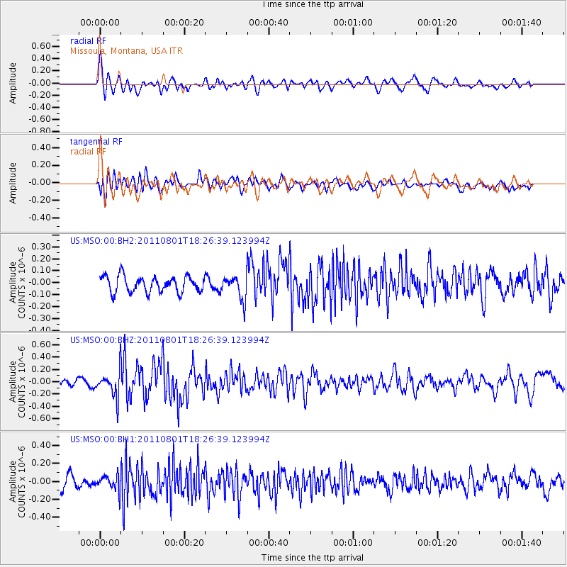
MSO Missoula, Montana, USA - Earthquake Result Viewer
*The percent match for this event was below the threshold and hence no stack was calculated.
| Earthquake location: |
Fox Islands, Aleutian Islands |
| Earthquake latitude/longitude: |
51.8/-171.3 |
| Earthquake time(UTC): |
2011/08/01 (213) 18:20:05 GMT |
| Earthquake Depth: |
41 km |
| Earthquake Magnitude: |
5.6 MW |
| Earthquake Catalog/Contributor: |
NEIC PDE/NEIC PDE-M |
|
| Network: |
US United States National Seismic Network |
| Station: |
MSO Missoula, Montana, USA |
| Lat/Lon: |
46.83 N/113.94 W |
| Elevation: |
1264 m |
|
| Distance: |
36.9 deg |
| Az: |
74.432 deg |
| Baz: |
299.382 deg |
| Ray Param: |
$rayparam |
*The percent match for this event was below the threshold and hence was not used in the summary stack. |
|
| Radial Match: |
69.659615 % |
| Radial Bump: |
400 |
| Transverse Match: |
62.977486 % |
| Transverse Bump: |
400 |
| SOD ConfigId: |
558545 |
| Insert Time: |
2013-09-19 00:14:35.711 +0000 |
| GWidth: |
2.5 |
| Max Bumps: |
400 |
| Tol: |
0.001 |
|
Signal To Noise
| Channel | StoN | STA | LTA |
| US:MSO:00:BHZ:20110801T18:26:39.123994Z | 3.0323017 | 2.2022266E-7 | 7.2625575E-8 |
| US:MSO:00:BH1:20110801T18:26:39.123994Z | 1.3305764 | 8.30061E-8 | 6.238356E-8 |
| US:MSO:00:BH2:20110801T18:26:39.123994Z | 1.5267452 | 1.0337089E-7 | 6.770671E-8 |
| Arrivals |
| Ps | |
| PpPs | |
| PsPs/PpSs | |


