You are here: Home > Network List > GS - US Geological Survey Networks Stations List
> Station KAN10 Keim Farm > Earthquake Result Viewer
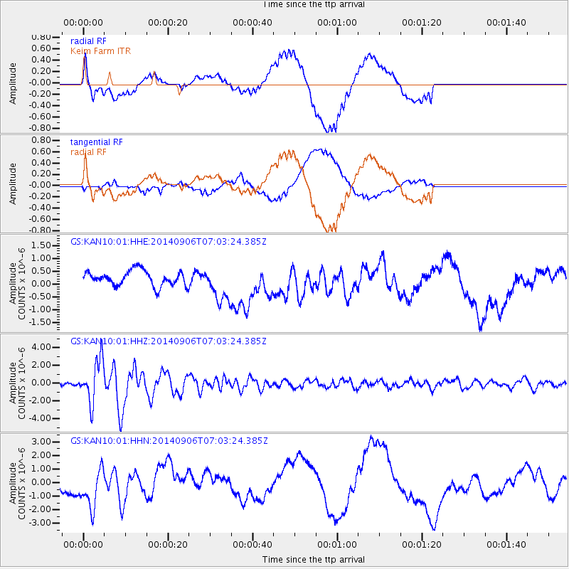
KAN10 Keim Farm - Earthquake Result Viewer
*The percent match for this event was below the threshold and hence no stack was calculated.
| Earthquake location: |
Easter Island Region |
| Earthquake latitude/longitude: |
-26.6/-114.5 |
| Earthquake time(UTC): |
2014/09/06 (249) 06:53:13 GMT |
| Earthquake Depth: |
10 km |
| Earthquake Magnitude: |
6.1 MB |
| Earthquake Catalog/Contributor: |
NEIC PDE/NEIC COMCAT |
|
| Network: |
GS US Geological Survey Networks |
| Station: |
KAN10 Keim Farm |
| Lat/Lon: |
37.12 N/98.10 W |
| Elevation: |
417 m |
|
| Distance: |
65.3 deg |
| Az: |
14.354 deg |
| Baz: |
196.12 deg |
| Ray Param: |
$rayparam |
*The percent match for this event was below the threshold and hence was not used in the summary stack. |
|
| Radial Match: |
65.43849 % |
| Radial Bump: |
400 |
| Transverse Match: |
51.320065 % |
| Transverse Bump: |
400 |
| SOD ConfigId: |
3390531 |
| Insert Time: |
2019-04-13 21:28:09.040 +0000 |
| GWidth: |
2.5 |
| Max Bumps: |
400 |
| Tol: |
0.001 |
|
Signal To Noise
| Channel | StoN | STA | LTA |
| GS:KAN10:01:HHZ:20140906T07:03:24.385Z | 17.80997 | 2.4240733E-6 | 1.3610764E-7 |
| GS:KAN10:01:HHN:20140906T07:03:24.385Z | 3.3692837 | 1.4357839E-6 | 4.261392E-7 |
| GS:KAN10:01:HHE:20140906T07:03:24.385Z | 2.3385236 | 6.7676604E-7 | 2.8939886E-7 |
| Arrivals |
| Ps | |
| PpPs | |
| PsPs/PpSs | |


