You are here: Home > Network List > II - Global Seismograph Network (GSN - IRIS/IDA) Stations List
> Station WRAB Tennant Creek, NT, Australia > Earthquake Result Viewer
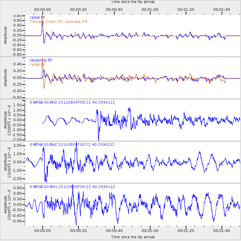
WRAB Tennant Creek, NT, Australia - Earthquake Result Viewer
*The percent match for this event was below the threshold and hence no stack was calculated.
| Earthquake location: |
Southern Sumatra, Indonesia |
| Earthquake latitude/longitude: |
-2.8/101.1 |
| Earthquake time(UTC): |
2011/08/04 (216) 00:16:07 GMT |
| Earthquake Depth: |
35 km |
| Earthquake Magnitude: |
5.8 MB, 5.5 MS, 5.8 MW, 5.6 MW |
| Earthquake Catalog/Contributor: |
WHDF/NEIC |
|
| Network: |
II Global Seismograph Network (GSN - IRIS/IDA) |
| Station: |
WRAB Tennant Creek, NT, Australia |
| Lat/Lon: |
19.93 S/134.36 E |
| Elevation: |
366 m |
|
| Distance: |
36.6 deg |
| Az: |
120.154 deg |
| Baz: |
293.37 deg |
| Ray Param: |
$rayparam |
*The percent match for this event was below the threshold and hence was not used in the summary stack. |
|
| Radial Match: |
74.088196 % |
| Radial Bump: |
400 |
| Transverse Match: |
69.4408 % |
| Transverse Bump: |
400 |
| SOD ConfigId: |
558545 |
| Insert Time: |
2013-09-19 00:20:01.619 +0000 |
| GWidth: |
2.5 |
| Max Bumps: |
400 |
| Tol: |
0.001 |
|
Signal To Noise
| Channel | StoN | STA | LTA |
| II:WRAB:00:BHZ:20110804T00:22:40.269011Z | 3.1397672 | 1.1965406E-6 | 3.8109215E-7 |
| II:WRAB:00:BH1:20110804T00:22:40.269011Z | 1.1150161 | 3.02456E-7 | 2.7125705E-7 |
| II:WRAB:00:BH2:20110804T00:22:40.269011Z | 3.031131 | 7.1411296E-7 | 2.3559289E-7 |
| Arrivals |
| Ps | |
| PpPs | |
| PsPs/PpSs | |


