You are here: Home > Network List > II - Global Seismograph Network (GSN - IRIS/IDA) Stations List
> Station WRAB Tennant Creek, NT, Australia > Earthquake Result Viewer
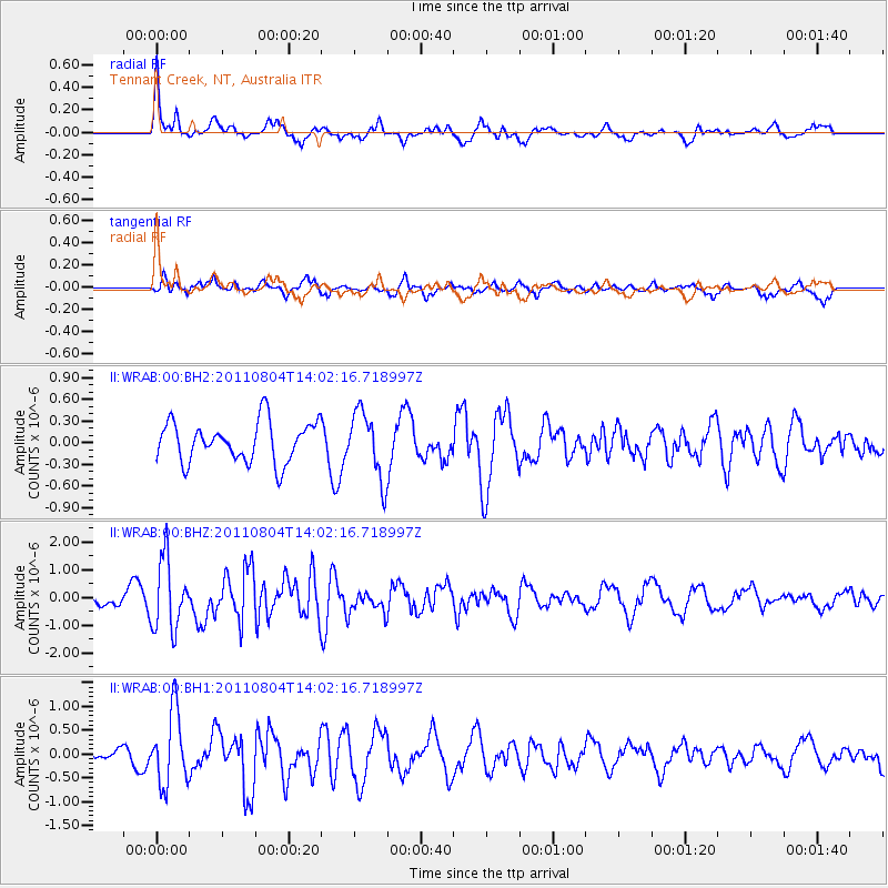
WRAB Tennant Creek, NT, Australia - Earthquake Result Viewer
*The percent match for this event was below the threshold and hence no stack was calculated.
| Earthquake location: |
Kuril Islands |
| Earthquake latitude/longitude: |
48.8/154.8 |
| Earthquake time(UTC): |
2011/08/04 (216) 13:51:34 GMT |
| Earthquake Depth: |
36 km |
| Earthquake Magnitude: |
6.0 MB, 5.8 MS, 6.1 MW, 6.0 MW |
| Earthquake Catalog/Contributor: |
WHDF/NEIC |
|
| Network: |
II Global Seismograph Network (GSN - IRIS/IDA) |
| Station: |
WRAB Tennant Creek, NT, Australia |
| Lat/Lon: |
19.93 S/134.36 E |
| Elevation: |
366 m |
|
| Distance: |
70.8 deg |
| Az: |
200.324 deg |
| Baz: |
14.119 deg |
| Ray Param: |
$rayparam |
*The percent match for this event was below the threshold and hence was not used in the summary stack. |
|
| Radial Match: |
70.09101 % |
| Radial Bump: |
376 |
| Transverse Match: |
62.818867 % |
| Transverse Bump: |
400 |
| SOD ConfigId: |
558545 |
| Insert Time: |
2013-09-19 00:21:47.610 +0000 |
| GWidth: |
2.5 |
| Max Bumps: |
400 |
| Tol: |
0.001 |
|
Signal To Noise
| Channel | StoN | STA | LTA |
| II:WRAB:00:BHZ:20110804T14:02:16.718997Z | 3.7450087 | 1.2641035E-6 | 3.3754353E-7 |
| II:WRAB:00:BH1:20110804T14:02:16.718997Z | 2.810991 | 7.662621E-7 | 2.72595E-7 |
| II:WRAB:00:BH2:20110804T14:02:16.718997Z | 1.6644518 | 4.596186E-7 | 2.761381E-7 |
| Arrivals |
| Ps | |
| PpPs | |
| PsPs/PpSs | |


