You are here: Home > Network List > II - Global Seismograph Network (GSN - IRIS/IDA) Stations List
> Station WRAB Tennant Creek, NT, Australia > Earthquake Result Viewer
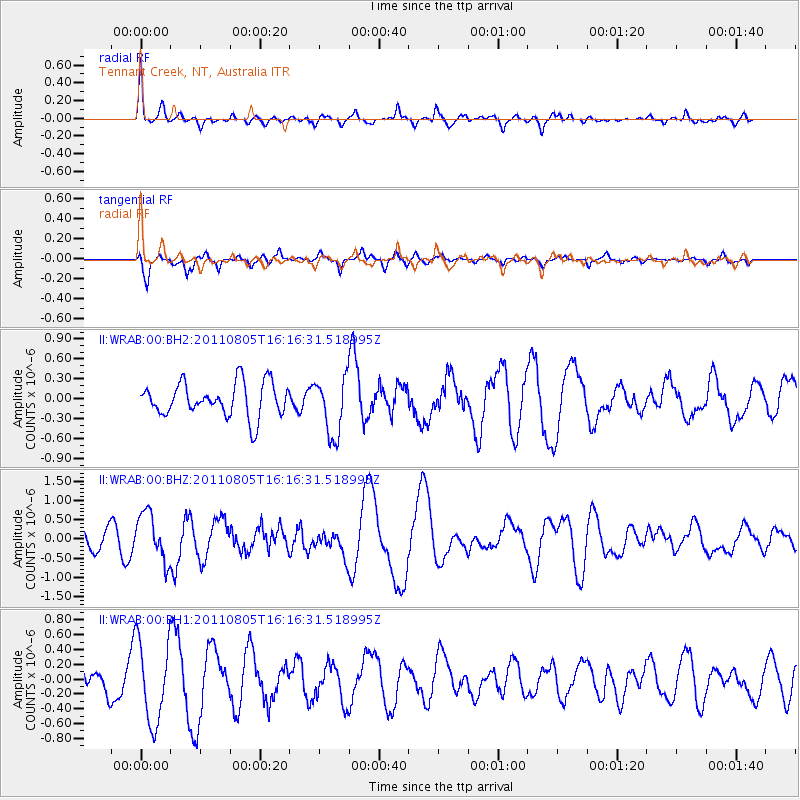
WRAB Tennant Creek, NT, Australia - Earthquake Result Viewer
*The percent match for this event was below the threshold and hence no stack was calculated.
| Earthquake location: |
Kermadec Islands Region |
| Earthquake latitude/longitude: |
-30.0/-176.7 |
| Earthquake time(UTC): |
2011/08/05 (217) 16:08:45 GMT |
| Earthquake Depth: |
10 km |
| Earthquake Magnitude: |
5.8 MS, 5.3 MB, 5.7 MW, 5.7 MW |
| Earthquake Catalog/Contributor: |
WHDF/NEIC |
|
| Network: |
II Global Seismograph Network (GSN - IRIS/IDA) |
| Station: |
WRAB Tennant Creek, NT, Australia |
| Lat/Lon: |
19.93 S/134.36 E |
| Elevation: |
366 m |
|
| Distance: |
45.2 deg |
| Az: |
271.089 deg |
| Baz: |
112.783 deg |
| Ray Param: |
$rayparam |
*The percent match for this event was below the threshold and hence was not used in the summary stack. |
|
| Radial Match: |
58.47435 % |
| Radial Bump: |
400 |
| Transverse Match: |
56.79913 % |
| Transverse Bump: |
400 |
| SOD ConfigId: |
558545 |
| Insert Time: |
2013-09-19 00:26:03.552 +0000 |
| GWidth: |
2.5 |
| Max Bumps: |
400 |
| Tol: |
0.001 |
|
Signal To Noise
| Channel | StoN | STA | LTA |
| II:WRAB:00:BHZ:20110805T16:16:31.518995Z | 2.357668 | 6.247436E-7 | 2.6498373E-7 |
| II:WRAB:00:BH1:20110805T16:16:31.518995Z | 2.4512491 | 5.5205646E-7 | 2.2521435E-7 |
| II:WRAB:00:BH2:20110805T16:16:31.518995Z | 1.7470391 | 4.375553E-7 | 2.5045534E-7 |
| Arrivals |
| Ps | |
| PpPs | |
| PsPs/PpSs | |


