You are here: Home > Network List > US - United States National Seismic Network Stations List
> Station HAWA Hanford, Washington, USA > Earthquake Result Viewer
HAWA Hanford, Washington, USA - Earthquake Result Viewer
*The percent match for this event was below the threshold and hence no stack was calculated.
| Earthquake location: |
Santa Cruz Islands Region |
| Earthquake latitude/longitude: |
-11.8/168.3 |
| Earthquake time(UTC): |
2011/08/07 (219) 06:22:34 GMT |
| Earthquake Depth: |
403 km |
| Earthquake Magnitude: |
5.7 MB, 5.7 MW, 5.7 MW |
| Earthquake Catalog/Contributor: |
WHDF/NEIC |
|
| Network: |
US United States National Seismic Network |
| Station: |
HAWA Hanford, Washington, USA |
| Lat/Lon: |
46.39 N/119.53 W |
| Elevation: |
364 m |
|
| Distance: |
86.5 deg |
| Az: |
41.307 deg |
| Baz: |
249.04 deg |
| Ray Param: |
$rayparam |
*The percent match for this event was below the threshold and hence was not used in the summary stack. |
|
| Radial Match: |
49.02232 % |
| Radial Bump: |
400 |
| Transverse Match: |
36.593216 % |
| Transverse Bump: |
400 |
| SOD ConfigId: |
558545 |
| Insert Time: |
2013-09-19 00:32:39.089 +0000 |
| GWidth: |
2.5 |
| Max Bumps: |
400 |
| Tol: |
0.001 |
|
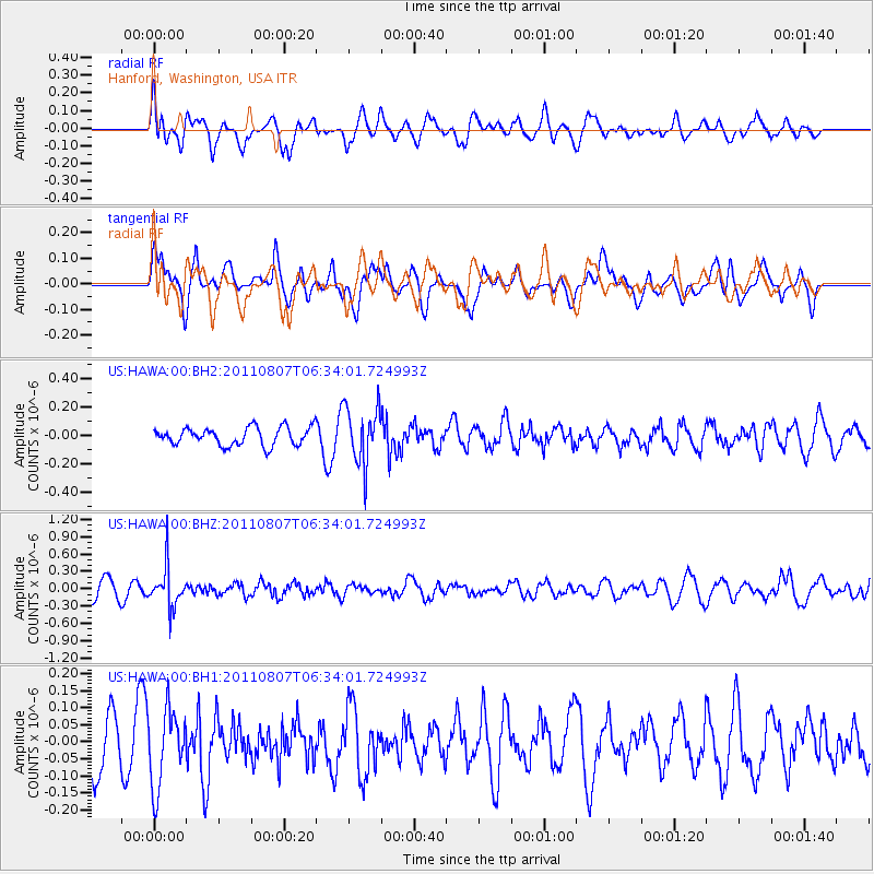
Signal To Noise
| Channel | StoN | STA | LTA |
| US:HAWA:00:BHZ:20110807T06:34:01.724993Z | 3.0642967 | 3.5774553E-7 | 1.16746385E-7 |
| US:HAWA:00:BH1:20110807T06:34:01.724993Z | 1.3318838 | 1.11066264E-7 | 8.3390354E-8 |
| US:HAWA:00:BH2:20110807T06:34:01.724993Z | 3.2709782 | 2.0557604E-7 | 6.284849E-8 |
| Arrivals |
| Ps | |
| PpPs | |
| PsPs/PpSs | |


