You are here: Home > Network List > IU - Global Seismograph Network (GSN - IRIS/USGS) Stations List
> Station PMG Port Moresby, New Guinea > Earthquake Result Viewer
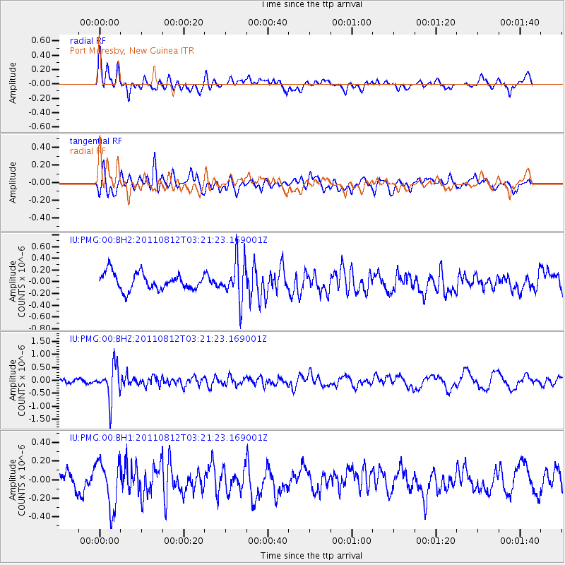
PMG Port Moresby, New Guinea - Earthquake Result Viewer
*The percent match for this event was below the threshold and hence no stack was calculated.
| Earthquake location: |
Fiji Islands Region |
| Earthquake latitude/longitude: |
-21.8/-177.0 |
| Earthquake time(UTC): |
2011/08/12 (224) 03:15:09 GMT |
| Earthquake Depth: |
219 km |
| Earthquake Magnitude: |
5.5 MW, 5.6 MW |
| Earthquake Catalog/Contributor: |
NEIC PDE/NEIC PDE-M |
|
| Network: |
IU Global Seismograph Network (GSN - IRIS/USGS) |
| Station: |
PMG Port Moresby, New Guinea |
| Lat/Lon: |
9.40 S/147.16 E |
| Elevation: |
90 m |
|
| Distance: |
36.5 deg |
| Az: |
284.06 deg |
| Baz: |
113.994 deg |
| Ray Param: |
$rayparam |
*The percent match for this event was below the threshold and hence was not used in the summary stack. |
|
| Radial Match: |
66.06802 % |
| Radial Bump: |
400 |
| Transverse Match: |
64.942406 % |
| Transverse Bump: |
400 |
| SOD ConfigId: |
558545 |
| Insert Time: |
2013-09-19 00:49:21.520 +0000 |
| GWidth: |
2.5 |
| Max Bumps: |
400 |
| Tol: |
0.001 |
|
Signal To Noise
| Channel | StoN | STA | LTA |
| IU:PMG:00:BHZ:20110812T03:21:23.169001Z | 10.904922 | 6.517359E-7 | 5.97653E-8 |
| IU:PMG:00:BH1:20110812T03:21:23.169001Z | 3.3920274 | 2.6090498E-7 | 7.691712E-8 |
| IU:PMG:00:BH2:20110812T03:21:23.169001Z | 2.530553 | 3.5719978E-7 | 1.4115483E-7 |
| Arrivals |
| Ps | |
| PpPs | |
| PsPs/PpSs | |


