You are here: Home > Network List > IU - Global Seismograph Network (GSN - IRIS/USGS) Stations List
> Station RSSD Black Hills, South Dakota, USA > Earthquake Result Viewer
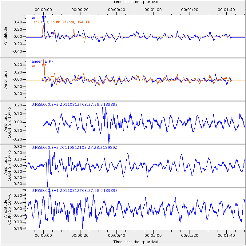
RSSD Black Hills, South Dakota, USA - Earthquake Result Viewer
*The percent match for this event was below the threshold and hence no stack was calculated.
| Earthquake location: |
Fiji Islands Region |
| Earthquake latitude/longitude: |
-21.8/-177.0 |
| Earthquake time(UTC): |
2011/08/12 (224) 03:15:09 GMT |
| Earthquake Depth: |
219 km |
| Earthquake Magnitude: |
5.5 MW, 5.6 MW |
| Earthquake Catalog/Contributor: |
NEIC PDE/NEIC PDE-M |
|
| Network: |
IU Global Seismograph Network (GSN - IRIS/USGS) |
| Station: |
RSSD Black Hills, South Dakota, USA |
| Lat/Lon: |
44.12 N/104.04 W |
| Elevation: |
2090 m |
|
| Distance: |
93.5 deg |
| Az: |
43.625 deg |
| Baz: |
242.905 deg |
| Ray Param: |
$rayparam |
*The percent match for this event was below the threshold and hence was not used in the summary stack. |
|
| Radial Match: |
55.715317 % |
| Radial Bump: |
400 |
| Transverse Match: |
37.83283 % |
| Transverse Bump: |
400 |
| SOD ConfigId: |
558545 |
| Insert Time: |
2013-09-19 00:49:31.781 +0000 |
| GWidth: |
2.5 |
| Max Bumps: |
400 |
| Tol: |
0.001 |
|
Signal To Noise
| Channel | StoN | STA | LTA |
| IU:RSSD:00:BHZ:20110812T03:27:28.218989Z | 3.1129189 | 1.1477748E-7 | 3.6871334E-8 |
| IU:RSSD:00:BH1:20110812T03:27:28.218989Z | 1.5782224 | 7.5425646E-8 | 4.779152E-8 |
| IU:RSSD:00:BH2:20110812T03:27:28.218989Z | 1.9069474 | 1.00544E-7 | 5.2725103E-8 |
| Arrivals |
| Ps | |
| PpPs | |
| PsPs/PpSs | |


