You are here: Home > Network List > X812 - Deep Structure of Three Continental Sutures in Eastern North America Stations List
> Station QM33 Maine > Earthquake Result Viewer
QM33 Maine - Earthquake Result Viewer

| Earthquake location: |
Easter Island Region |
| Earthquake latitude/longitude: |
-26.6/-114.5 |
| Earthquake time(UTC): |
2014/09/06 (249) 06:53:13 GMT |
| Earthquake Depth: |
10 km |
| Earthquake Magnitude: |
6.1 MB |
| Earthquake Catalog/Contributor: |
NEIC PDE/NEIC COMCAT |
|
| Network: |
X8 Deep Structure of Three Continental Sutures in Eastern North America |
| Station: |
QM33 Maine |
| Lat/Lon: |
47.21 N/69.40 W |
| Elevation: |
0.0 m |
|
| Distance: |
84.0 deg |
| Az: |
29.023 deg |
| Baz: |
219.574 deg |
| Ray Param: |
0.045806553 |
| Estimated Moho Depth: |
67.25 km |
| Estimated Crust Vp/Vs: |
2.00 |
| Assumed Crust Vp: |
6.419 km/s |
| Estimated Crust Vs: |
3.206 km/s |
| Estimated Crust Poisson's Ratio: |
0.33 |
|
| Radial Match: |
82.78695 % |
| Radial Bump: |
400 |
| Transverse Match: |
76.36617 % |
| Transverse Bump: |
400 |
| SOD ConfigId: |
3390531 |
| Insert Time: |
2019-04-13 21:32:50.424 +0000 |
| GWidth: |
2.5 |
| Max Bumps: |
400 |
| Tol: |
0.001 |
|
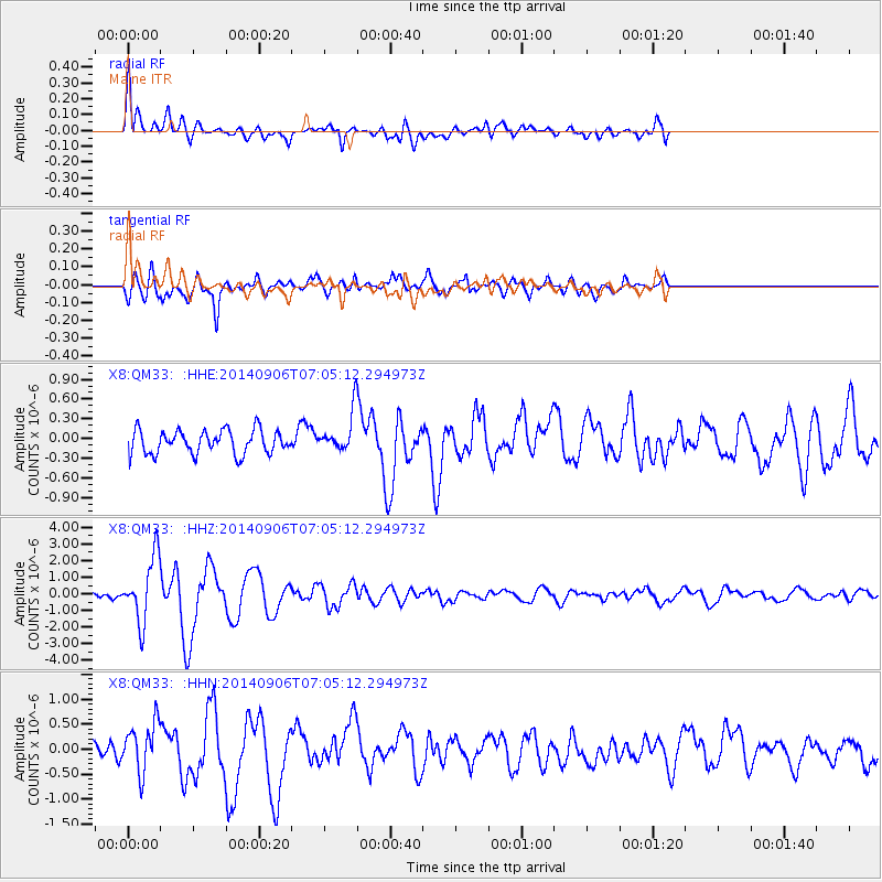
Signal To Noise
| Channel | StoN | STA | LTA |
| X8:QM33: :HHZ:20140906T07:05:12.294973Z | 8.259043 | 1.942323E-6 | 2.3517532E-7 |
| X8:QM33: :HHN:20140906T07:05:12.294973Z | 3.704084 | 4.9651595E-7 | 1.3404555E-7 |
| X8:QM33: :HHE:20140906T07:05:12.294973Z | 1.8366867 | 3.31758E-7 | 1.806285E-7 |
| Arrivals |
| Ps | 11 SECOND |
| PpPs | 31 SECOND |
| PsPs/PpSs | 42 SECOND |


