INK INUVIK, NT, CANADA.ANADA - Earthquake Result Viewer
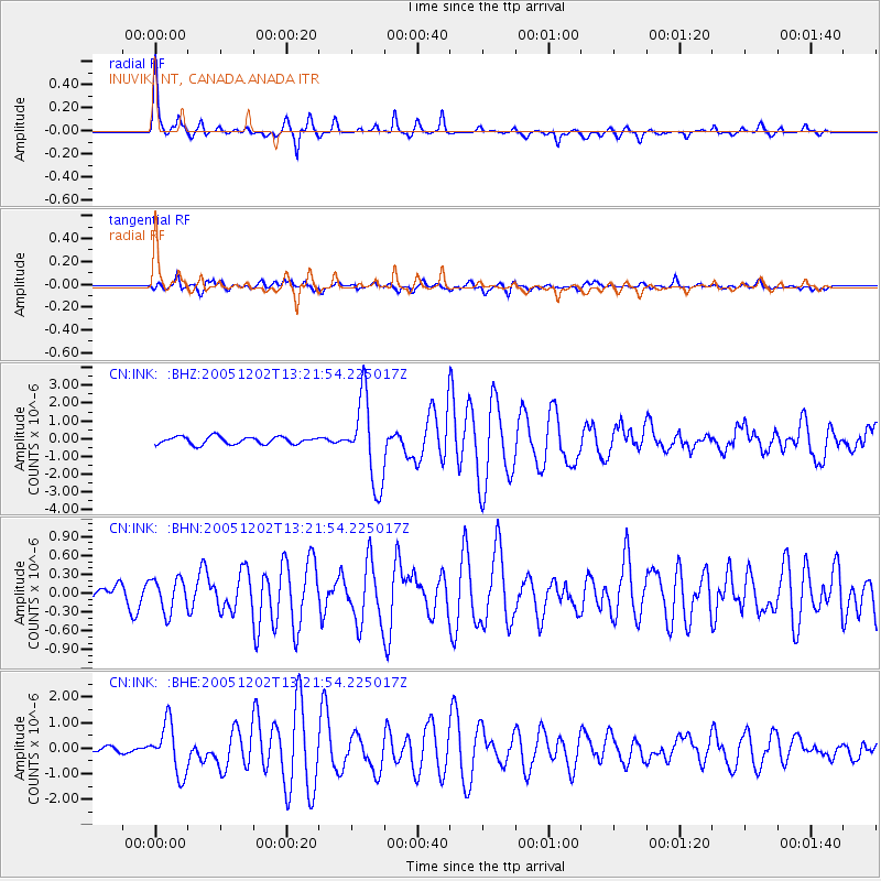
Earthquake location: Near East Coast Of Honshu, Japan
Earthquake latitude/longitude: 38.1/142.1
Earthquake time(UTC): 2005/12/02 (336) 13:13:09 GMT
Earthquake Depth: 29 km
Earthquake Magnitude: 6.1 MB, 6.3 MS, 6.5 MW, 6.4 MW
Earthquake Catalog/Contributor: WHDF/NEIC
Network: CN Canadian National Seismograph Network
Station: INK INUVIK, NT, CANADA.ANADA
Lat/Lon: 68.31 N/133.52 W
Elevation: 40 m
Distance: 53.2 deg
Az: 27.523 deg
Baz: 281.263 deg
Ray Param: 0.06621305
Estimated Moho Depth: 33.25 km
Estimated Crust Vp/Vs: 1.64
Assumed Crust Vp: 6.171 km/s
Estimated Crust Vs: 3.763 km/s
Estimated Crust Poisson's Ratio: 0.20
Radial Match: 95.8026 %
Radial Bump: 242
Transverse Match: 81.87481 %
Transverse Bump: 400
SOD ConfigId: 2564
Insert Time: 2010-02-27 06:18:13.523 +0000
GWidth: 2.5
Max Bumps: 400
Tol: 0.001

Signal To Noise

ChannelStoNSTALTA
CN:INK: :BHN:20051202T13:21:54.225017Z1.75906382.6268668E-71.4933325E-7
CN:INK: :BHE:20051202T13:21:54.225017Z8.0094089.6978E-71.2108012E-7
CN:INK: :BHZ:20051202T13:21:54.225017Z11.3983772.3627122E-62.0728496E-7
Arrivals
Ps3.6 SECOND
PpPs13 SECOND
PsPs/PpSs17 SECOND