You are here: Home > Network List > II - Global Seismograph Network (GSN - IRIS/IDA) Stations List
> Station WRAB Tennant Creek, NT, Australia > Earthquake Result Viewer
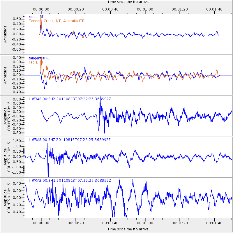
WRAB Tennant Creek, NT, Australia - Earthquake Result Viewer
*The percent match for this event was below the threshold and hence no stack was calculated.
| Earthquake location: |
Kermadec Islands, New Zealand |
| Earthquake latitude/longitude: |
-30.6/-177.9 |
| Earthquake time(UTC): |
2011/08/13 (225) 07:14:47 GMT |
| Earthquake Depth: |
10 km |
| Earthquake Magnitude: |
5.5 MW |
| Earthquake Catalog/Contributor: |
NEIC PDE/NEIC PDE-M |
|
| Network: |
II Global Seismograph Network (GSN - IRIS/IDA) |
| Station: |
WRAB Tennant Creek, NT, Australia |
| Lat/Lon: |
19.93 S/134.36 E |
| Elevation: |
366 m |
|
| Distance: |
44.1 deg |
| Az: |
272.29 deg |
| Baz: |
113.623 deg |
| Ray Param: |
$rayparam |
*The percent match for this event was below the threshold and hence was not used in the summary stack. |
|
| Radial Match: |
58.153553 % |
| Radial Bump: |
396 |
| Transverse Match: |
73.06913 % |
| Transverse Bump: |
400 |
| SOD ConfigId: |
558545 |
| Insert Time: |
2013-09-19 00:52:58.432 +0000 |
| GWidth: |
2.5 |
| Max Bumps: |
400 |
| Tol: |
0.001 |
|
Signal To Noise
| Channel | StoN | STA | LTA |
| II:WRAB:00:BHZ:20110813T07:22:25.368992Z | 3.5088623 | 5.101092E-7 | 1.4537738E-7 |
| II:WRAB:00:BH1:20110813T07:22:25.368992Z | 1.1725138 | 1.4708382E-7 | 1.2544314E-7 |
| II:WRAB:00:BH2:20110813T07:22:25.368992Z | 2.6293209 | 3.206283E-7 | 1.2194339E-7 |
| Arrivals |
| Ps | |
| PpPs | |
| PsPs/PpSs | |


