AGMN Agassiz National Wildlife Refuge, Minnesota, USA - Earthquake Result Viewer
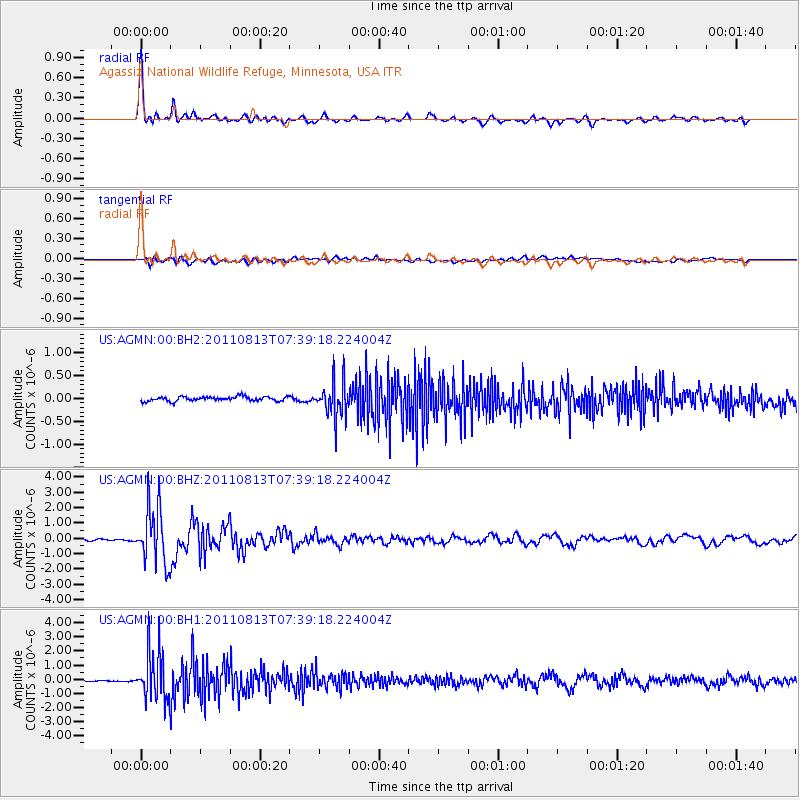
Earthquake location: Off Coast Of Chiapas, Mexico
Earthquake latitude/longitude: 14.4/-94.7
Earthquake time(UTC): 2011/08/13 (225) 07:33:06 GMT
Earthquake Depth: 6.0 km
Earthquake Magnitude: 5.7 MB, 5.2 MS, 5.8 MW, 5.6 MW
Earthquake Catalog/Contributor: WHDF/NEIC
Network: US United States National Seismic Network
Station: AGMN Agassiz National Wildlife Refuge, Minnesota, USA
Lat/Lon: 48.30 N/95.86 W
Elevation: 351 m
Distance: 33.8 deg
Az: 358.575 deg
Baz: 177.932 deg
Ray Param: 0.078040466
Estimated Moho Depth: 55.25 km
Estimated Crust Vp/Vs: 1.60
Assumed Crust Vp: 6.419 km/s
Estimated Crust Vs: 4.012 km/s
Estimated Crust Poisson's Ratio: 0.18
Radial Match: 95.67545 %
Radial Bump: 337
Transverse Match: 75.46653 %
Transverse Bump: 400
SOD ConfigId: 558545
Insert Time: 2013-09-19 00:55:21.828 +0000
GWidth: 2.5
Max Bumps: 400
Tol: 0.001

Signal To Noise

ChannelStoNSTALTA
US:AGMN:00:BHZ:20110813T07:39:18.224004Z26.3308681.8556057E-67.047263E-8
US:AGMN:00:BH1:20110813T07:39:18.224004Z41.9151.7249795E-64.1154227E-8
US:AGMN:00:BH2:20110813T07:39:18.224004Z8.0349543.8559205E-74.798933E-8
Arrivals
Ps5.6 SECOND
PpPs21 SECOND
PsPs/PpSs26 SECOND