ERPA Erie, Pennsylvania, USA - Earthquake Result Viewer
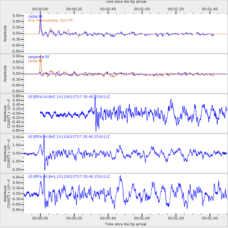
Earthquake location: Off Coast Of Chiapas, Mexico
Earthquake latitude/longitude: 14.4/-94.7
Earthquake time(UTC): 2011/08/13 (225) 07:33:06 GMT
Earthquake Depth: 6.0 km
Earthquake Magnitude: 5.7 MB, 5.2 MS, 5.8 MW, 5.6 MW
Earthquake Catalog/Contributor: WHDF/NEIC
Network: US United States National Seismic Network
Station: ERPA Erie, Pennsylvania, USA
Lat/Lon: 42.12 N/79.99 W
Elevation: 306 m
Distance: 30.4 deg
Az: 21.879 deg
Baz: 209.035 deg
Ray Param: 0.07934523
Estimated Moho Depth: 59.75 km
Estimated Crust Vp/Vs: 2.10
Assumed Crust Vp: 6.419 km/s
Estimated Crust Vs: 3.064 km/s
Estimated Crust Poisson's Ratio: 0.35
Radial Match: 91.20978 %
Radial Bump: 384
Transverse Match: 61.8577 %
Transverse Bump: 400
SOD ConfigId: 558545
Insert Time: 2013-09-19 00:55:41.936 +0000
GWidth: 2.5
Max Bumps: 400
Tol: 0.001

Signal To Noise

ChannelStoNSTALTA
US:ERPA:00:BHZ:20110813T07:38:48.350011Z15.5597771.002556E-66.443254E-8
US:ERPA:00:BH1:20110813T07:38:48.350011Z8.4479685.040597E-75.9666384E-8
US:ERPA:00:BH2:20110813T07:38:48.350011Z4.8141423.5381808E-77.3495556E-8
Arrivals
Ps11 SECOND
PpPs27 SECOND
PsPs/PpSs38 SECOND