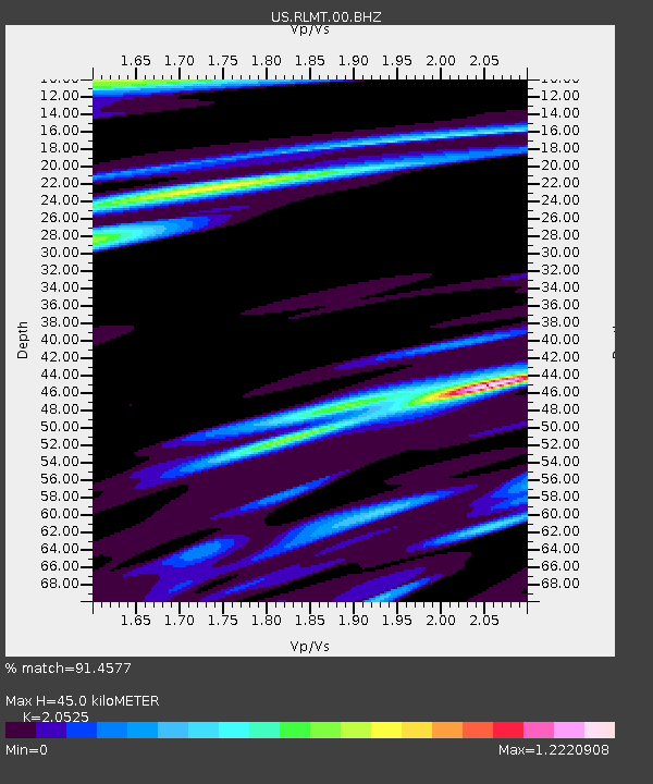
RLMT Red Lodge, Montana, USA - Earthquake Result Viewer
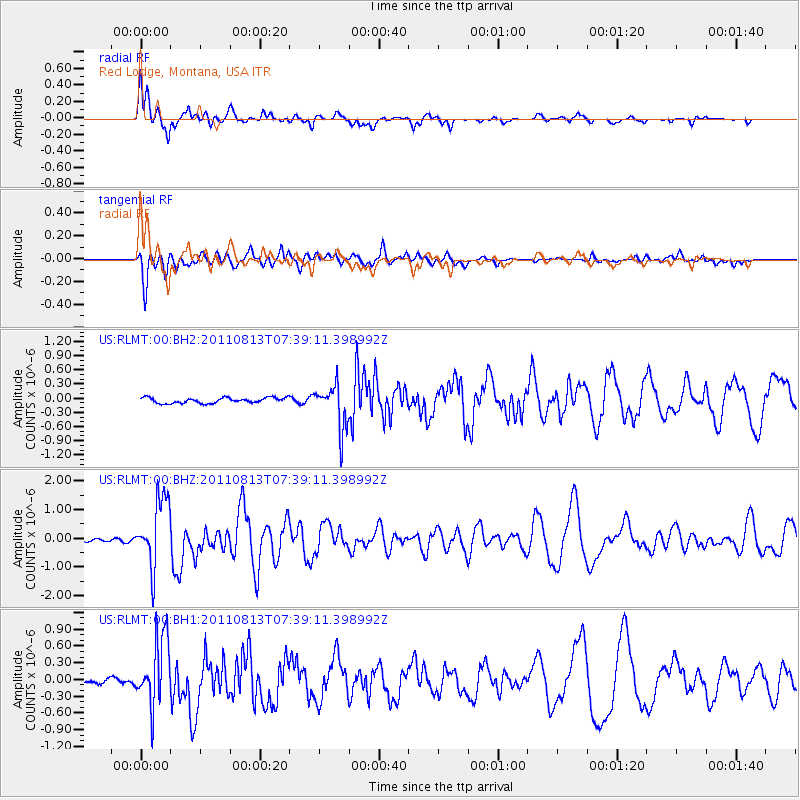
Earthquake location: Off Coast Of Chiapas, Mexico
Earthquake latitude/longitude: 14.4/-94.7
Earthquake time(UTC): 2011/08/13 (225) 07:33:06 GMT
Earthquake Depth: 6.0 km
Earthquake Magnitude: 5.7 MB, 5.2 MS, 5.8 MW, 5.6 MW
Earthquake Catalog/Contributor: WHDF/NEIC
Network: US United States National Seismic Network
Station: RLMT Red Lodge, Montana, USA
Lat/Lon: 45.12 N/109.27 W
Elevation: 2086 m
Distance: 33.0 deg
Az: 340.899 deg
Baz: 153.392 deg
Ray Param: 0.07840346
Estimated Moho Depth: 45.0 km
Estimated Crust Vp/Vs: 2.05
Assumed Crust Vp: 6.242 km/s
Estimated Crust Vs: 3.041 km/s
Estimated Crust Poisson's Ratio: 0.34
Radial Match: 91.4577 %
Radial Bump: 400
Transverse Match: 80.0384 %
Transverse Bump: 400
SOD ConfigId: 558545
Insert Time: 2013-09-19 00:56:16.782 +0000
GWidth: 2.5
Max Bumps: 400
Tol: 0.001

Signal To Noise

ChannelStoNSTALTA
US:RLMT:00:BHZ:20110813T07:39:11.398992Z9.80116751.1866788E-61.2107525E-7
US:RLMT:00:BH1:20110813T07:39:11.398992Z11.0633866.0786806E-75.4944124E-8
US:RLMT:00:BH2:20110813T07:39:11.398992Z8.0366574.5919475E-75.7137534E-8
Arrivals
Ps8.1 SECOND
PpPs21 SECOND
PsPs/PpSs29 SECOND