You are here: Home > Network List > US - United States National Seismic Network Stations List
> Station GLMI Grayling, Michigan, USA > Earthquake Result Viewer
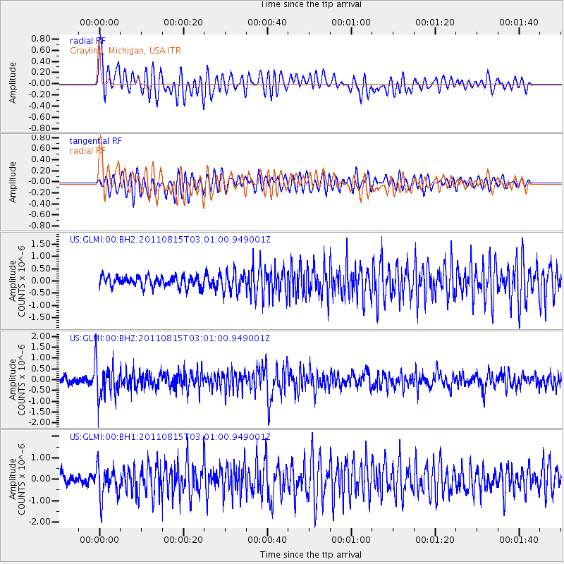
GLMI Grayling, Michigan, USA - Earthquake Result Viewer
*The percent match for this event was below the threshold and hence no stack was calculated.
| Earthquake location: |
Ecuador |
| Earthquake latitude/longitude: |
-1.8/-76.9 |
| Earthquake time(UTC): |
2011/08/15 (227) 02:53:18 GMT |
| Earthquake Depth: |
177 km |
| Earthquake Magnitude: |
5.7 MB, 5.7 MW, 5.7 MW |
| Earthquake Catalog/Contributor: |
WHDF/NEIC |
|
| Network: |
US United States National Seismic Network |
| Station: |
GLMI Grayling, Michigan, USA |
| Lat/Lon: |
44.82 N/84.62 W |
| Elevation: |
387 m |
|
| Distance: |
46.9 deg |
| Az: |
352.492 deg |
| Baz: |
169.426 deg |
| Ray Param: |
$rayparam |
*The percent match for this event was below the threshold and hence was not used in the summary stack. |
|
| Radial Match: |
63.614937 % |
| Radial Bump: |
400 |
| Transverse Match: |
59.918877 % |
| Transverse Bump: |
400 |
| SOD ConfigId: |
558545 |
| Insert Time: |
2013-09-19 01:01:40.557 +0000 |
| GWidth: |
2.5 |
| Max Bumps: |
400 |
| Tol: |
0.001 |
|
Signal To Noise
| Channel | StoN | STA | LTA |
| US:GLMI:00:BHZ:20110815T03:01:00.949001Z | 5.559557 | 8.252168E-7 | 1.4843211E-7 |
| US:GLMI:00:BH1:20110815T03:01:00.949001Z | 3.034673 | 7.3207997E-7 | 2.412385E-7 |
| US:GLMI:00:BH2:20110815T03:01:00.949001Z | 1.892759 | 4.0516707E-7 | 2.1406163E-7 |
| Arrivals |
| Ps | |
| PpPs | |
| PsPs/PpSs | |


