You are here: Home > Network List > US - United States National Seismic Network Stations List
> Station MNTX Cornudas Mountains, Texas, USA > Earthquake Result Viewer
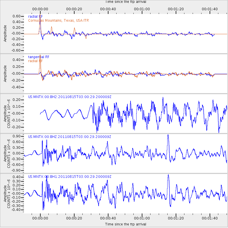
MNTX Cornudas Mountains, Texas, USA - Earthquake Result Viewer
*The percent match for this event was below the threshold and hence no stack was calculated.
| Earthquake location: |
Ecuador |
| Earthquake latitude/longitude: |
-1.8/-76.9 |
| Earthquake time(UTC): |
2011/08/15 (227) 02:53:18 GMT |
| Earthquake Depth: |
177 km |
| Earthquake Magnitude: |
5.7 MB, 5.7 MW, 5.7 MW |
| Earthquake Catalog/Contributor: |
WHDF/NEIC |
|
| Network: |
US United States National Seismic Network |
| Station: |
MNTX Cornudas Mountains, Texas, USA |
| Lat/Lon: |
31.70 N/105.38 W |
| Elevation: |
404 m |
|
| Distance: |
42.9 deg |
| Az: |
323.349 deg |
| Baz: |
135.577 deg |
| Ray Param: |
$rayparam |
*The percent match for this event was below the threshold and hence was not used in the summary stack. |
|
| Radial Match: |
79.234955 % |
| Radial Bump: |
294 |
| Transverse Match: |
55.88911 % |
| Transverse Bump: |
349 |
| SOD ConfigId: |
558545 |
| Insert Time: |
2013-09-19 01:02:27.080 +0000 |
| GWidth: |
2.5 |
| Max Bumps: |
400 |
| Tol: |
0.001 |
|
Signal To Noise
| Channel | StoN | STA | LTA |
| US:MNTX:00:BHZ:20110815T03:00:29.200009Z | 4.230307 | 3.3482058E-7 | 7.914806E-8 |
| US:MNTX:00:BH1:20110815T03:00:29.200009Z | 4.144368 | 1.9359125E-7 | 4.6711882E-8 |
| US:MNTX:00:BH2:20110815T03:00:29.200009Z | 3.1720352 | 1.2326804E-7 | 3.886087E-8 |
| Arrivals |
| Ps | |
| PpPs | |
| PsPs/PpSs | |


