INK INUVIK, NT, CANADA.ANADA - Earthquake Result Viewer
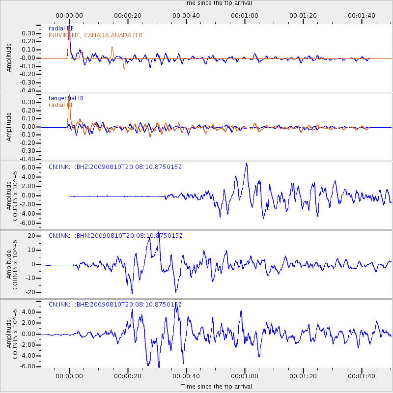
Earthquake location: Andaman Islands, India Region
Earthquake latitude/longitude: 14.1/92.9
Earthquake time(UTC): 2009/08/10 (222) 19:55:35 GMT
Earthquake Depth: 4.7 km
Earthquake Magnitude: 6.9 MB, 7.6 MS, 7.5 MW, 7.5 MW
Earthquake Catalog/Contributor: WHDF/NEIC
Network: CN Canadian National Seismograph Network
Station: INK INUVIK, NT, CANADA.ANADA
Lat/Lon: 68.31 N/133.52 W
Elevation: 40 m
Distance: 91.4 deg
Az: 15.626 deg
Baz: 315.337 deg
Ray Param: 0.0416073
Estimated Moho Depth: 25.0 km
Estimated Crust Vp/Vs: 1.91
Assumed Crust Vp: 6.171 km/s
Estimated Crust Vs: 3.231 km/s
Estimated Crust Poisson's Ratio: 0.31
Radial Match: 96.86745 %
Radial Bump: 383
Transverse Match: 94.52562 %
Transverse Bump: 400
SOD ConfigId: 2622
Insert Time: 2010-02-27 06:19:00.964 +0000
GWidth: 2.5
Max Bumps: 400
Tol: 0.001

Signal To Noise

ChannelStoNSTALTA
CN:INK: :BHN:20090810T20:08:10.875015Z18.0983411.063665E-65.877141E-8
CN:INK: :BHE:20090810T20:08:10.875015Z4.9855912.6325046E-75.2802257E-8
CN:INK: :BHZ:20090810T20:08:10.875015Z4.4254371.9939579E-74.5056748E-8
Arrivals
Ps3.8 SECOND
PpPs12 SECOND
PsPs/PpSs15 SECOND