You are here: Home > Network List > US - United States National Seismic Network Stations List
> Station CBKS Cedar Bluff, Kansas, USA > Earthquake Result Viewer
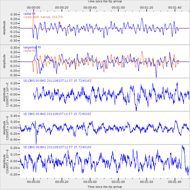
CBKS Cedar Bluff, Kansas, USA - Earthquake Result Viewer
*The percent match for this event was below the threshold and hence no stack was calculated.
| Earthquake location: |
Volcano Islands, Japan Region |
| Earthquake latitude/longitude: |
22.6/143.0 |
| Earthquake time(UTC): |
2011/08/15 (227) 11:44:38 GMT |
| Earthquake Depth: |
132 km |
| Earthquake Magnitude: |
5.6 MB |
| Earthquake Catalog/Contributor: |
NEIC PDE/NEIC PDE-M |
|
| Network: |
US United States National Seismic Network |
| Station: |
CBKS Cedar Bluff, Kansas, USA |
| Lat/Lon: |
38.81 N/99.74 W |
| Elevation: |
677 m |
|
| Distance: |
95.2 deg |
| Az: |
44.234 deg |
| Baz: |
304.423 deg |
| Ray Param: |
$rayparam |
*The percent match for this event was below the threshold and hence was not used in the summary stack. |
|
| Radial Match: |
49.729134 % |
| Radial Bump: |
400 |
| Transverse Match: |
72.79607 % |
| Transverse Bump: |
400 |
| SOD ConfigId: |
558545 |
| Insert Time: |
2013-09-19 01:05:16.345 +0000 |
| GWidth: |
2.5 |
| Max Bumps: |
400 |
| Tol: |
0.001 |
|
Signal To Noise
| Channel | StoN | STA | LTA |
| US:CBKS:00:BHZ:20110815T11:57:15.724016Z | 2.1883955 | 1.6759287E-7 | 7.658253E-8 |
| US:CBKS:00:BH1:20110815T11:57:15.724016Z | 1.0881873 | 7.487843E-8 | 6.8810245E-8 |
| US:CBKS:00:BH2:20110815T11:57:15.724016Z | 1.0305663 | 6.0853296E-8 | 5.90484E-8 |
| Arrivals |
| Ps | |
| PpPs | |
| PsPs/PpSs | |


