You are here: Home > Network List > IU - Global Seismograph Network (GSN - IRIS/USGS) Stations List
> Station HNR Honiara, Solomon Islands > Earthquake Result Viewer
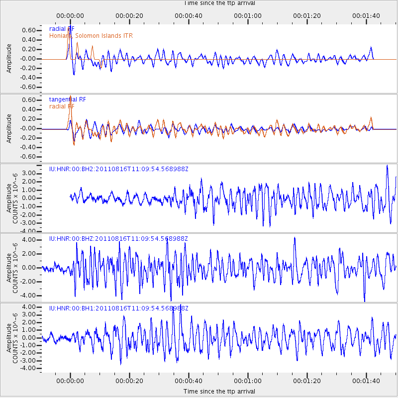
HNR Honiara, Solomon Islands - Earthquake Result Viewer
*The percent match for this event was below the threshold and hence no stack was calculated.
| Earthquake location: |
Ceram Sea |
| Earthquake latitude/longitude: |
-2.3/128.0 |
| Earthquake time(UTC): |
2011/08/16 (228) 11:03:57 GMT |
| Earthquake Depth: |
35 km |
| Earthquake Magnitude: |
6.1 MB, 5.7 MS, 6.0 MW, 5.9 MW |
| Earthquake Catalog/Contributor: |
WHDF/NEIC |
|
| Network: |
IU Global Seismograph Network (GSN - IRIS/USGS) |
| Station: |
HNR Honiara, Solomon Islands |
| Lat/Lon: |
9.44 S/159.95 E |
| Elevation: |
100 m |
|
| Distance: |
32.5 deg |
| Az: |
103.877 deg |
| Baz: |
280.53 deg |
| Ray Param: |
$rayparam |
*The percent match for this event was below the threshold and hence was not used in the summary stack. |
|
| Radial Match: |
75.71504 % |
| Radial Bump: |
400 |
| Transverse Match: |
71.701355 % |
| Transverse Bump: |
400 |
| SOD ConfigId: |
558545 |
| Insert Time: |
2013-09-19 01:07:01.161 +0000 |
| GWidth: |
2.5 |
| Max Bumps: |
400 |
| Tol: |
0.001 |
|
Signal To Noise
| Channel | StoN | STA | LTA |
| IU:HNR:00:BHZ:20110816T11:09:54.568988Z | 5.860672 | 1.6685934E-6 | 2.8471027E-7 |
| IU:HNR:00:BH1:20110816T11:09:54.568988Z | 1.3547164 | 5.576521E-7 | 4.1163747E-7 |
| IU:HNR:00:BH2:20110816T11:09:54.568988Z | 0.9799537 | 4.2159488E-7 | 4.302192E-7 |
| Arrivals |
| Ps | |
| PpPs | |
| PsPs/PpSs | |


