
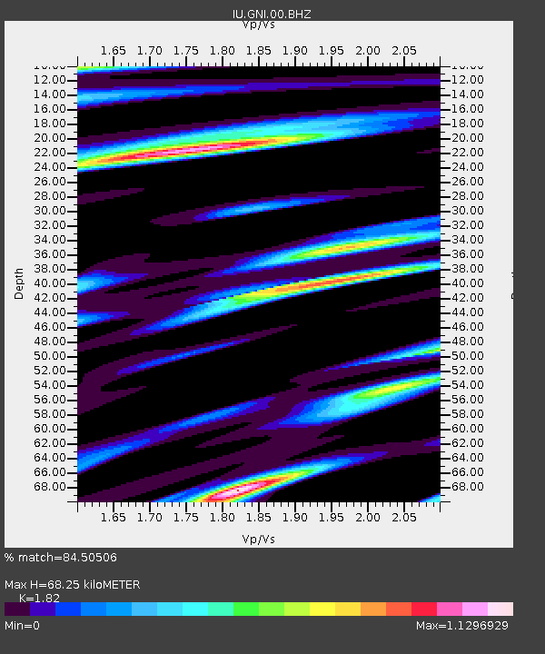
GNI Garni, Armenia - Earthquake Result Viewer
| ||||||||||||||||||
| ||||||||||||||||||
| ||||||||||||||||||
|
Signal To Noise
| Channel | StoN | STA | LTA |
| IU:GNI:00:BHZ:20110817T11:55:09.218999Z | 12.892504 | 9.1189474E-7 | 7.0730614E-8 |
| IU:GNI:00:BH1:20110817T11:55:09.218999Z | 3.2246294 | 1.6939845E-7 | 5.2532688E-8 |
| IU:GNI:00:BH2:20110817T11:55:09.218999Z | 2.1505814 | 1.941166E-7 | 9.026238E-8 |
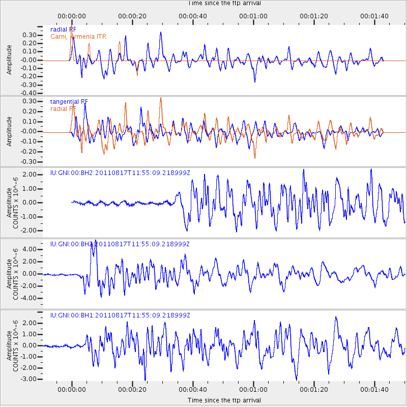
| Arrivals | |
| Ps | 9.2 SECOND |
| PpPs | 30 SECOND |
| PsPs/PpSs | 39 SECOND |

