You are here: Home > Network List > US - United States National Seismic Network Stations List
> Station DGMT Dagmar, Montana, USA > Earthquake Result Viewer
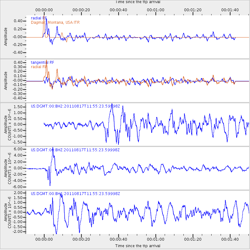
DGMT Dagmar, Montana, USA - Earthquake Result Viewer
*The percent match for this event was below the threshold and hence no stack was calculated.
| Earthquake location: |
Off East Coast Of Honshu, Japan |
| Earthquake latitude/longitude: |
36.8/143.8 |
| Earthquake time(UTC): |
2011/08/17 (229) 11:44:08 GMT |
| Earthquake Depth: |
9.0 km |
| Earthquake Magnitude: |
6.1 MB, 5.8 MS, 6.2 MW, 6.1 MW |
| Earthquake Catalog/Contributor: |
WHDF/NEIC |
|
| Network: |
US United States National Seismic Network |
| Station: |
DGMT Dagmar, Montana, USA |
| Lat/Lon: |
48.47 N/104.20 W |
| Elevation: |
0.0 m |
|
| Distance: |
75.9 deg |
| Az: |
39.507 deg |
| Baz: |
309.859 deg |
| Ray Param: |
$rayparam |
*The percent match for this event was below the threshold and hence was not used in the summary stack. |
|
| Radial Match: |
95.38587 % |
| Radial Bump: |
400 |
| Transverse Match: |
83.148796 % |
| Transverse Bump: |
400 |
| SOD ConfigId: |
558545 |
| Insert Time: |
2013-09-19 01:12:58.076 +0000 |
| GWidth: |
2.5 |
| Max Bumps: |
400 |
| Tol: |
0.001 |
|
Signal To Noise
| Channel | StoN | STA | LTA |
| US:DGMT:00:BHZ:20110817T11:55:23.59998Z | 24.869896 | 2.5950776E-6 | 1.0434614E-7 |
| US:DGMT:00:BH1:20110817T11:55:23.59998Z | 3.4025083 | 4.855391E-7 | 1.4270034E-7 |
| US:DGMT:00:BH2:20110817T11:55:23.59998Z | 3.6901371 | 5.411197E-7 | 1.4663944E-7 |
| Arrivals |
| Ps | |
| PpPs | |
| PsPs/PpSs | |


