
LAO LASA Array, Montana, USA - Earthquake Result Viewer
| ||||||||||||||||||
| ||||||||||||||||||
| ||||||||||||||||||
|
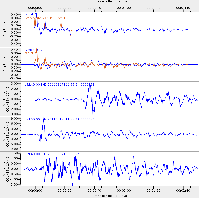
Signal To Noise
| Channel | StoN | STA | LTA |
| US:LAO:00:BHZ:20110817T11:55:24.000005Z | 20.394623 | 1.7319209E-6 | 8.4920465E-8 |
| US:LAO:00:BH1:20110817T11:55:24.000005Z | 1.5593001 | 1.2866107E-7 | 8.2512074E-8 |
| US:LAO:00:BH2:20110817T11:55:24.000005Z | 3.9766955 | 5.743501E-7 | 1.4442898E-7 |
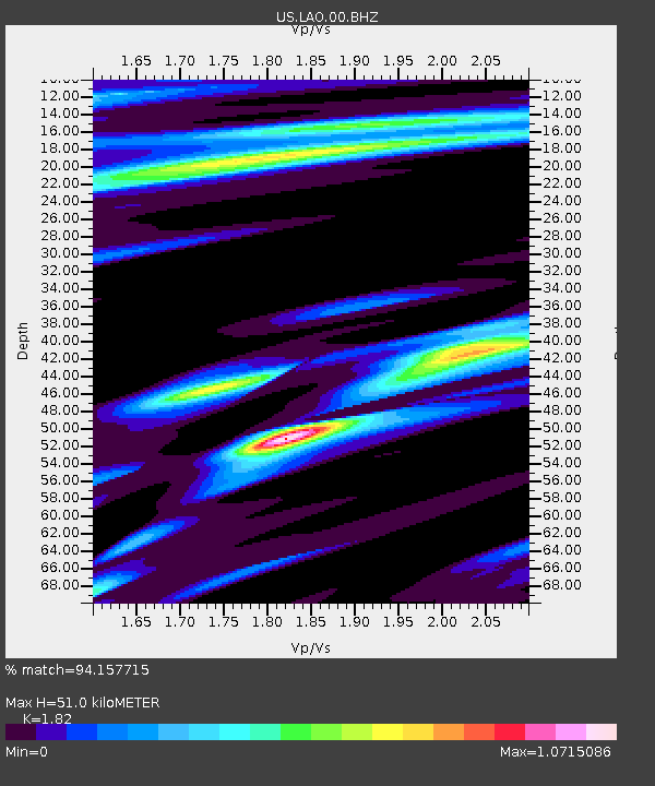
| Arrivals | |
| Ps | 6.7 SECOND |
| PpPs | 22 SECOND |
| PsPs/PpSs | 28 SECOND |

