MIAR Mount Ida, Arkansas, USA - Earthquake Result Viewer
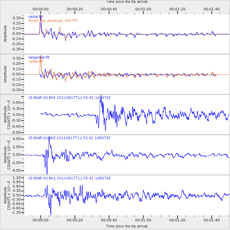
Earthquake location: Off East Coast Of Honshu, Japan
Earthquake latitude/longitude: 36.8/143.8
Earthquake time(UTC): 2011/08/17 (229) 11:44:08 GMT
Earthquake Depth: 9.0 km
Earthquake Magnitude: 6.1 MB, 5.8 MS, 6.2 MW, 6.1 MW
Earthquake Catalog/Contributor: WHDF/NEIC
Network: US United States National Seismic Network
Station: MIAR Mount Ida, Arkansas, USA
Lat/Lon: 34.55 N/93.58 W
Elevation: 207 m
Distance: 91.2 deg
Az: 44.039 deg
Baz: 317.448 deg
Ray Param: 0.041617945
Estimated Moho Depth: 23.25 km
Estimated Crust Vp/Vs: 2.08
Assumed Crust Vp: 6.498 km/s
Estimated Crust Vs: 3.128 km/s
Estimated Crust Poisson's Ratio: 0.35
Radial Match: 95.46717 %
Radial Bump: 400
Transverse Match: 84.18625 %
Transverse Bump: 400
SOD ConfigId: 558545
Insert Time: 2013-09-19 01:14:01.451 +0000
GWidth: 2.5
Max Bumps: 400
Tol: 0.001

Signal To Noise

ChannelStoNSTALTA
US:MIAR:00:BHZ:20110817T11:56:42.198979Z32.502121.6031203E-64.932356E-8
US:MIAR:00:BH1:20110817T11:56:42.198979Z4.61782262.4656075E-75.3393293E-8
US:MIAR:00:BH2:20110817T11:56:42.198979Z5.0272822.443029E-74.8595417E-8
Arrivals
Ps3.9 SECOND
PpPs11 SECOND
PsPs/PpSs15 SECOND