
OGNE Ogallala, Nebraska, USA - Earthquake Result Viewer
| ||||||||||||||||||
| ||||||||||||||||||
| ||||||||||||||||||
|
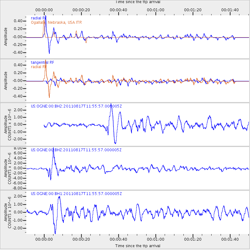
Signal To Noise
| Channel | StoN | STA | LTA |
| US:OGNE:00:BHZ:20110817T11:55:57.000005Z | 20.28099 | 2.1326382E-6 | 1.0515454E-7 |
| US:OGNE:00:BH1:20110817T11:55:57.000005Z | 3.8709493 | 4.4908677E-7 | 1.1601463E-7 |
| US:OGNE:00:BH2:20110817T11:55:57.000005Z | 3.3022292 | 4.6263816E-7 | 1.4009875E-7 |
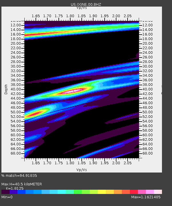
| Arrivals | |
| Ps | 5.2 SECOND |
| PpPs | 17 SECOND |
| PsPs/PpSs | 22 SECOND |

