TPNV Topopah Spring, Nevada, USA - Earthquake Result Viewer
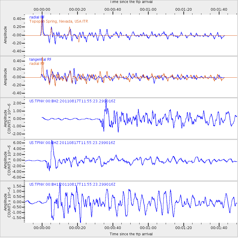
Earthquake location: Off East Coast Of Honshu, Japan
Earthquake latitude/longitude: 36.8/143.8
Earthquake time(UTC): 2011/08/17 (229) 11:44:08 GMT
Earthquake Depth: 9.0 km
Earthquake Magnitude: 6.1 MB, 5.8 MS, 6.2 MW, 6.1 MW
Earthquake Catalog/Contributor: WHDF/NEIC
Network: US United States National Seismic Network
Station: TPNV Topopah Spring, Nevada, USA
Lat/Lon: 36.95 N/116.25 W
Elevation: 1600 m
Distance: 75.8 deg
Az: 54.472 deg
Baz: 305.336 deg
Ray Param: 0.051422033
Estimated Moho Depth: 48.5 km
Estimated Crust Vp/Vs: 2.07
Assumed Crust Vp: 6.279 km/s
Estimated Crust Vs: 3.037 km/s
Estimated Crust Poisson's Ratio: 0.35
Radial Match: 91.36759 %
Radial Bump: 400
Transverse Match: 87.879906 %
Transverse Bump: 400
SOD ConfigId: 558545
Insert Time: 2013-09-19 01:14:37.948 +0000
GWidth: 2.5
Max Bumps: 400
Tol: 0.001

Signal To Noise

ChannelStoNSTALTA
US:TPNV:00:BHZ:20110817T11:55:23.299016Z10.5330011.3310697E-61.2637136E-7
US:TPNV:00:BH1:20110817T11:55:23.299016Z3.42044733.3736308E-79.863127E-8
US:TPNV:00:BH2:20110817T11:55:23.299016Z4.764543.660662E-77.683138E-8
Arrivals
Ps8.5 SECOND
PpPs23 SECOND
PsPs/PpSs32 SECOND